The Mawson Trail is South Australia's great long-distance bike ride. It stretches almost 900 km from the Adelaide Hills to Blinman in the Flinders Ranges, passing through some of the state's best-loved landscapes: the Adelaide Hills, the Barossa and Clare wine valleys, the historic town of Burra, the wheatlands of the mid-north and the rugged, ancient ranges of the outback.
It's a trail with a grassroots story, built by cyclists for cyclists. This guide covers its history, the route and towns, what bike to ride, the seasons and how to prepare.
Trail overview
~900 km
Length
Adelaide Hills to Blinman
1990
Planning began
By cycling groups
2002
Biennial guided tour
Run by Bicycle SA since
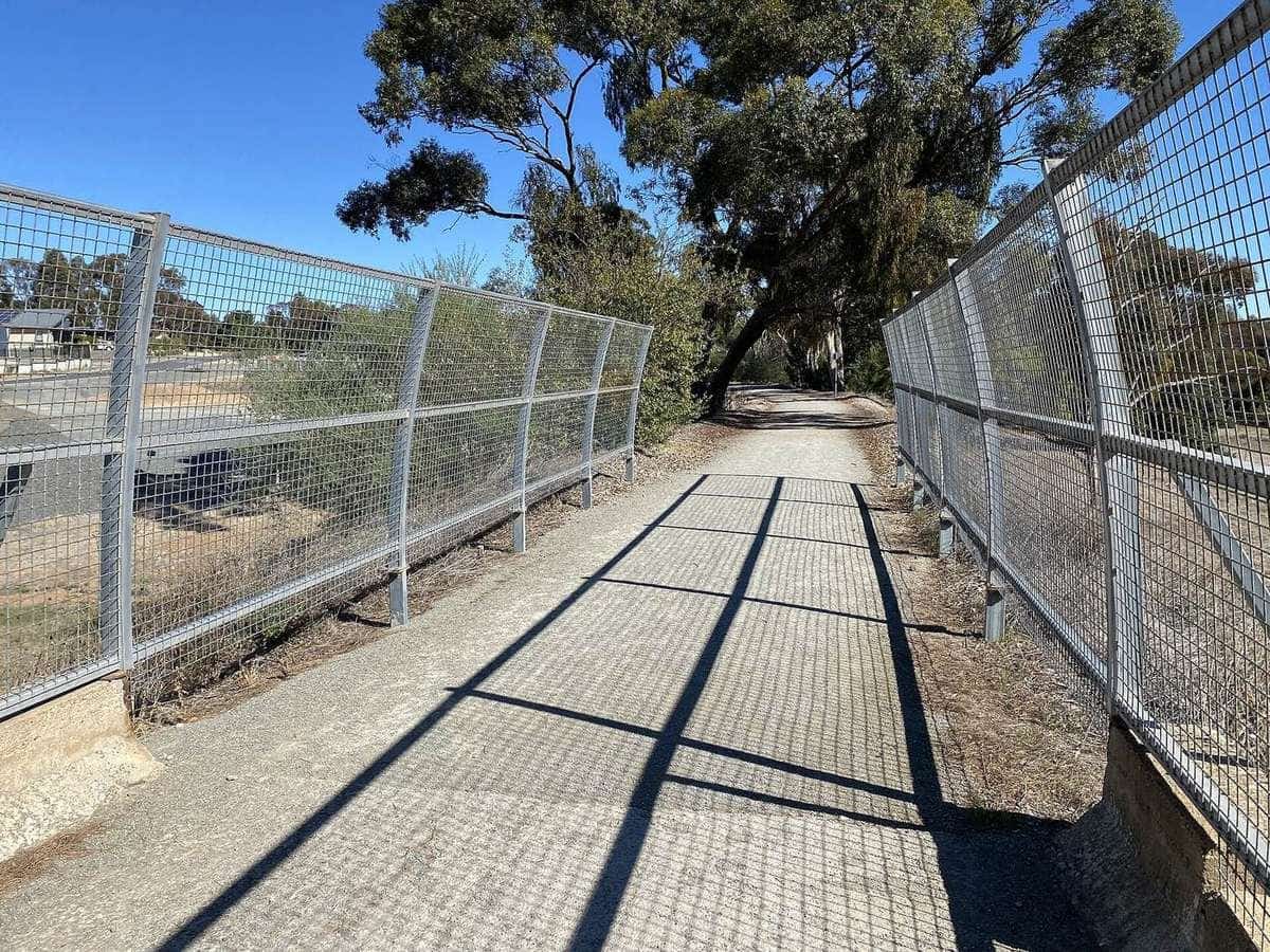
The trail starts just east of Adelaide in the Adelaide Hills, at the upstream end of the Torrens Linear Park on Gorge Road, and extends almost 900 km to Blinman. The Linear Park connects the start by dedicated cycleway to the coast at West Beach. The route traverses remote areas of the Mount Lofty and Flinders Ranges, mostly away from bitumen roads, often off-road on tracks, unmade roads and forest reserves. It passes through a number of country towns along the way.
History
The Mawson Trail is a great example of community effort. In early 1990, members of the SA Touring Cyclists' Association (now Bicycle SA) rode from Blinman to Adelaide to test a route for an off-road cycling trail. In June 1990, a group representing several cycling organisations met to plan the trail. Volunteers then marked it out and established it, using state forest and national park fire trails, farm access tracks, unmade or unused roads, and roads with very little traffic, according to Wikipedia.
The trail was named after Douglas Mawson, the geologist and Antarctic explorer who carried out geological studies in the Flinders Ranges.
The route and towns
The route is generally described south to north, though it can be ridden in either direction, with signage for both. Towns along the way include:
| Town | Notes from Wikipedia |
|---|---|
| Lobethal | Historic town with German settler history |
| Birdwood | Home of the National Motor Museum |
| Rowland Flat, Tanunda, Nuriootpa | Barossa Valley towns with bakeries, pubs and cafes |
| Kapunda, Riverton, Auburn | Cafes, pubs and supermarkets |
| Clare | Large town with supermarket, bike shop and cafes |
| Burra | Historic town with pubs, supermarkets and cafes |
| Hallett, Spalding | Small towns with a store and pub |
| Laura, Melrose, Wilmington | Supermarket, cafes; Melrose has a bike shop cafe |
| Quorn | Historic town with several pubs and cafes |
| Cradock, Hawker | Tiny hamlet with a pub; small town with roadhouse |
| Rawnsley Park, Wilpena | Caravan parks and campsites in the Flinders Ranges |
| Blinman | Small tourist village with pub and mine tours |
Adelaide Hills and the Barossa
From the Adelaide Hills, the trail heads north through Lobethal and Birdwood into the Barossa Valley, with its wineries, bakeries and historic towns of Tanunda and Nuriootpa.
Clare Valley and the mid-north
Beyond Kapunda and Riverton, the trail reaches Auburn and Clare in the Clare Valley, close to the gentle Riesling Trail. It continues north to Burra, a large historic town, and across the open farming country of the mid-north.
Southern Flinders Ranges
Through Laura, Melrose and Wilmington, the trail enters the southern Flinders Ranges. Melrose sits at the foot of Mount Remarkable.
Flinders Ranges
North of Quorn, the trail heads into the outback Flinders Ranges through Cradock and Hawker, past Wilpena and Rawnsley Park, to finish at Blinman. This is remote country, with long distances between services.
Bikes
The Mawson Trail is suitable for mountain bikes, according to Wikipedia. With its fire trails, farm tracks and unmade roads, many riders choose a mountain bike or a sturdy gravel or touring bike with wide tyres. Carry a good repair kit, spare tubes, a tyre plug kit and the tools to fix common problems.
Seasons
South Australia's summers are hot and dry, and the northern sections of the trail can be extremely hot. Autumn, winter and spring are generally better for riding, with cooler temperatures. Winter can bring rain and mud in the Mount Lofty Ranges and cold nights in the Flinders. Check the fire danger rating and trail closures before and during your ride: some sections pass through forests and parks that close on high fire danger days.
Planning your ride
How long does it take?
Riding the whole trail takes most people a few weeks. Many riders do it in sections, such as the Barossa and Clare valleys, or the Flinders Ranges. Our ride planner includes the Mawson Trail.
Guided or independent?
According to Wikipedia, Bicycle SA has hosted a guided two-week tour of the entire length every second year since 2002. Other operators offer guided tours, support vehicles and luggage transfers on parts of the trail. Read our guided or self-guided tours guide.
Navigation
The trail is signposted in both directions, but carry maps and a GPS route. Mobile coverage is limited in parts of the ranges. A personal locator beacon (PLB) or satellite messenger is strongly recommended for remote sections.
Safety
- Helmets are compulsory in South Australia.
- Heat: avoid riding in extreme heat, especially in the north.
- Roads: some sections use roads. In South Australia, drivers must leave at least 1 m when passing a cyclist where the limit is 60 km/h or less, and 1.5 m above that.
- Remoteness: carry spares, food, water and a first aid kit.
- Gates and stock: leave gates as you find them on farm tracks.
Mawson Trail checklist
0 of 7 done
Ticks are saved in this browser only.
Choosing a section
Many riders start with the southern sections through the Adelaide Hills, the Barossa and the Clare Valley, where towns are close together and services are plentiful. The northern sections through the Flinders Ranges are more remote and rewarding, but demand more planning for water, food and accommodation. A popular approach is to ride the trail over several trips, a region at a time, using a car shuttle or public transport to reach the start and finish of each section.
Respecting the land
The Mawson Trail crosses farmland, forest reserves and national parks. Leave gates as you find them, stay on the marked route, camp only where permitted and carry out all rubbish.
Key points
The Mawson Trail runs almost 900 km from the Adelaide Hills to Blinman in the Flinders Ranges, through the Barossa, Clare Valley, Burra and the southern Flinders. Built by volunteers from 1990 and named after Douglas Mawson, it uses fire trails, farm tracks and quiet roads, and suits mountain bikes. Ride it in sections or over a few weeks, carry plenty of water in the north, and check fire danger and closures.
Related guides
Pair it with the Riesling Trail, or compare the Munda Biddi Trail.
Frequently asked questions
How long is the Mawson Trail?
The Mawson Trail extends almost 900 km from just east of Adelaide in the Adelaide Hills to Blinman in the Flinders Ranges.
Who is the Mawson Trail named after?
It is named after geologist and Antarctic explorer Douglas Mawson, who carried out geological studies in the Flinders Ranges.
What bike do I need for the Mawson Trail?
The trail is suitable for mountain bikes. It uses fire trails, farm tracks, unmade roads and low-traffic roads, so a mountain bike or sturdy gravel or touring bike with wide tyres is best.
Which direction should I ride?
The route is generally described south to north, but it can be ridden in either direction, and signage is provided both ways.
Are there guided tours of the Mawson Trail?
According to Wikipedia, Bicycle SA has hosted a guided two-week tour of the entire length every second year since 2002. Other operators also offer tours and support.
Sources and further reading
Facts on this page were checked against these primary and official sources. Conditions change — confirm before you travel or buy.
- Mawson Trail — Wikipedia
- Riesling Trail — Wikipedia
- Cycling laws — Government of South Australia