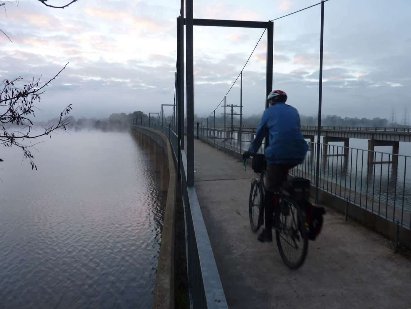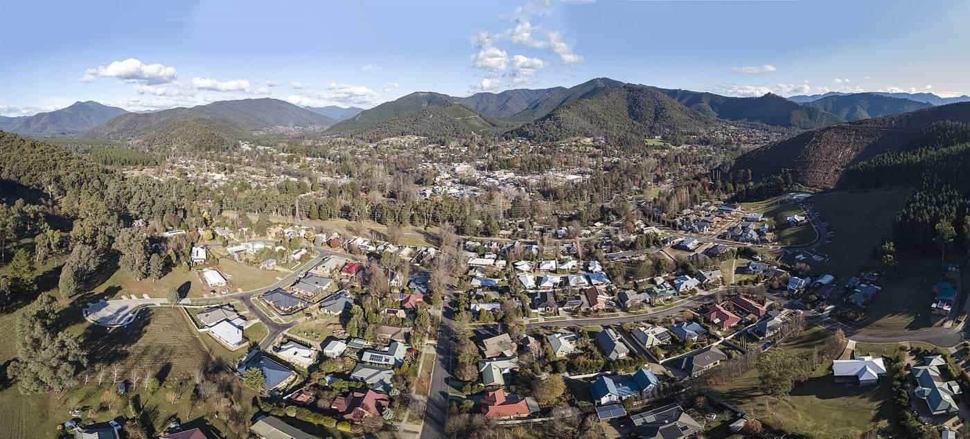
In Victoria's north-east, the old Bright railway line once climbed the Ovens Valley from Wangaratta towards the mountains. Today it is the Murray to Mountains Rail Trail, a ride through farmland, vineyards and river flats, with the peaks of the Victorian Alps getting closer with every kilometre.
What sets this trail apart is its surface. Unusually for a rail trail, it is sealed for virtually its entire length, making it accessible to almost every kind of bike and rider, from road bikes to kids' bikes to e-bikes. This guide covers the route, the stages, the Beechworth branch and how to plan a ride.
Trail overview
~95 km
Main sealed trail
Wangaratta–Bright plus Beechworth branch
Sealed
Surface
Virtually the entire distance
A$12m
Yackandandah extension
Budgeted May 2017
The Murray to Mountains Rail Trail runs from Wangaratta to Bright, with a side branch to Beechworth, following the route of the former Bright railway line. According to Wikipedia, it is sealed for virtually the entire distance of approximately 95 km.
The trail network has grown over the years. A section from Rutherglen to Wahgunyah on the Murray was completed in 2009, and there is an on-road "preferred route" connecting Rutherglen to Bowser via Chiltern. A third section extends south from Wangaratta to Oxley, connecting with a bike path to Milawa. The Beechworth branch is planned to be extended to Yackandandah, with A$12 million budgeted by the Victorian Government in May 2017.
Stages
Wikipedia lists the landmarks along the main trail with approximate distances between them:
| From | To | Distance |
|---|---|---|
| Wangaratta | Bowser | 8 km |
| Bowser | Londrigan (former station) | 3 km |
| Londrigan | Tarrawingee (former station) | 8 km |
| Tarrawingee | Everton (former station) | 6 km |
| Everton | Brooksfield (former station) | 6 km |
| Brooksfield | Bowman (former station) | 8 km |
| Bowman | Gapsted (former station) | 6 km |
| Gapsted | Myrtleford | 8 km |
| Myrtleford | Ovens | 5 km |
| Ovens | St Clements Church | 7 km |
| St Clements Church | Eurobin (former station) | 9 km |
| Eurobin | Porepunkah | 8 km |
| Porepunkah | Bright | 7 km |
The Beechworth branch leaves the main trail near Everton, passing the former Baarmutha station on the way to Beechworth, about 15 km in total.
The route
Wangaratta to Everton
The trail starts in Wangaratta, a regional city on the Ovens River, and heads south-east across flat farmland past Bowser, Londrigan and Tarrawingee to Everton. This is easy, open riding.
The Beechworth branch
From near Everton, the branch climbs to Beechworth, a historic gold-rush town with bakeries and cafes. The climb is long but steady, and the ride back down to the main trail is a reward.
Everton to Myrtleford
The main trail follows the Ovens Valley past old station sites at Brooksfield, Bowman and Gapsted to Myrtleford, a valley town with cafes and accommodation.
Myrtleford to Bright
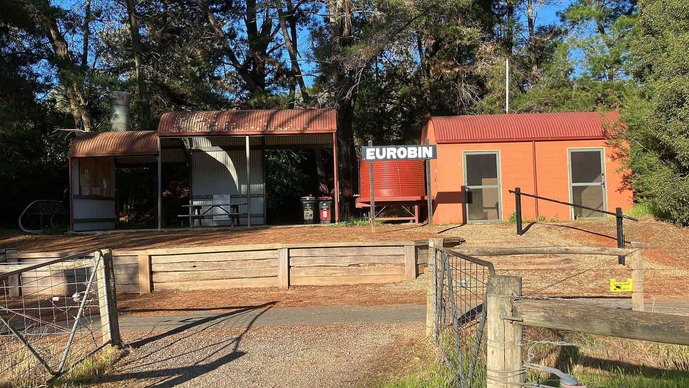
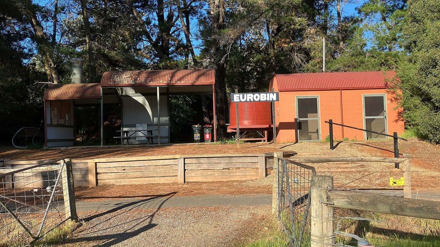
The final section runs up the Ovens Valley through Ovens, Eurobin and Porepunkah to Bright, with Mount Buffalo looming above. At the former Eurobin station, a rest stop shaped like a steam train is a favourite photo spot. Bright is a lively tourist town with plenty of food, accommodation and bike shops, and a base for road cycling and mountain biking in the Alps.
Bikes and riders
Because the trail is sealed, almost any bike will do: road, hybrid, gravel, mountain or e-bike. That makes it one of the best rail trails in Australia for families and less confident riders. Bike hire is commonly available in the trail towns, including electric bikes. Check with local businesses.
Planning your ride
How many days?
Some fit riders cover the main trail in a day, while others take two or three days, stopping in Myrtleford and Beechworth or Bright. Our ride planner includes the Murray to Mountains and lets you set your own pace.
Direction
Riding from Wangaratta to Bright heads up the valley towards the mountains, with gradual gains along the way. Riding from Bright to Wangaratta is generally easier. Many riders use a shuttle to start in Bright and ride down the valley.
Food and wine
The region is known for its food and wine, with wineries, breweries, cheese and produce close to the trail, especially around Milawa, Myrtleford and Bright. If you plan to visit wineries, pace yourself: alcohol and bikes don't mix well.
Seasons and safety
North-east Victoria has hot summers and cold winters. Autumn, with colourful foliage around Bright, and spring are popular times to ride. In summer, ride early and check the fire danger rating, as the Alpine region can face high bushfire risk. In winter, frost and fog are common in the valley mornings.
- Helmets are compulsory in Victoria.
- Share the trail with walkers, families and other riders. The sealed surface attracts lots of users.
- Road crossings: take care at crossings, especially near towns.
- Speed: the smooth surface invites speed, but slow down around others.
Murray to Mountains checklist
0 of 6 done
Ticks are saved in this browser only.
Sample itineraries
These are starting points only. Adjust them with the ride planner and check accommodation first.
- Half day, families: Porepunkah to Bright and back on the smooth sealed trail.
- Day ride: Myrtleford to Bright, or Bright to Myrtleford with a shuttle back.
- Weekend: Wangaratta to Beechworth on day one, including the climb up the branch, then back down and on to Myrtleford or Bright on day two.
- Extended trip: add the Rutherglen to Wahgunyah section and the path from Oxley to Milawa for a longer food-and-wine tour.
Riding with kids
The sealed surface makes the Murray to Mountains one of the best family rail trails in Australia. Short sections near Bright and Porepunkah suit young children, with trailers, tag-alongs and balance bikes all practical on the smooth path. Plan short distances with plenty of stops, bring snacks and water, make sure every child has a properly fitted helmet, and take care at road crossings and near busy trailheads in town.
Supporting the trail
Spending money in trail towns, respecting neighbouring farms and reporting damage to the trail manager all help keep the trail in good shape for everyone.
Key points
The Murray to Mountains Rail Trail runs from Wangaratta to Bright, with a branch to Beechworth, along the former Bright railway line. It is sealed for virtually its entire distance of around 95 km, so it suits almost any bike and rider. The Ovens Valley offers food, wine and mountain views, and the trail can be ridden in a day or over several days. Check the fire danger in summer and dress for frosty mornings in winter.
Related guides
Compare the Great Victorian Rail Trail, and read our guided or self-guided tours guide.
Frequently asked questions
How long is the Murray to Mountains Rail Trail?
The main trail from Wangaratta to Bright, with the branch to Beechworth, is sealed for virtually its entire distance of approximately 95 km, according to Wikipedia. Additional sections link Rutherglen to Wahgunyah and Wangaratta to Oxley.
Is the Murray to Mountains Rail Trail sealed?
Yes. Unusually for a rail trail, it is sealed for virtually the entire distance, which makes it suitable for most bikes, including road bikes.
Where does the trail go?
From Wangaratta through Everton, Myrtleford and Porepunkah to Bright, with a side branch from Everton to Beechworth. It follows the route of the former Bright railway line.
Is the Beechworth branch hard?
The branch climbs from the main trail up to Beechworth, so expect a longer climb heading to the town and an enjoyable descent on the way back.
Is there an extension planned to Yackandandah?
Yes. The Beechworth branch is planned to be extended to Yackandandah, and the Victorian Government budgeted A$12 million for the extension in May 2017, according to Wikipedia. Check the official website for current status.
Sources and further reading
Facts on this page were checked against these primary and official sources. Conditions change — confirm before you travel or buy.
- Murray to the Mountains Rail Trail — Wikipedia
- Rail trail — Wikipedia
- Cycling in Australia — Wikipedia