The New South Wales ride this guide documents in depth is not a coastal highway. It is the Northern Rivers Rail Trail, in two official pieces that you can finish in a day each. The trail’s own FAQ is the source for the numbers: 24 km from Murwillumbah to Crabbes Creek, and 29.7 km from Casino to Lismore. Destination NSW is the state tourism body for the wider region. It is not the trail manager, and it does not get to invent a third open section.
That is a different kind of destination from Victoria’s sealed 137 km network or Queensland’s 161 km gravel spine. NSW on this site is a beginner destination in the sense that each open section is a day, not a week. It is also a subtropical destination, which means heat, humidity and flood are planning constraints. The Bureau of Meteorology climate pages for Murwillumbah, Lismore and Casino are more useful than a brochure that says “beautiful all year”.
24 km
Tweed section
Murwillumbah to Crabbes Creek, official FAQ
29.7 km
Casino to Lismore
Official FAQ
250 W
E-bicycles
Trail FAQ limit; no e-scooters
Destination NSW as context
Visit NSW’s Northern Rivers Rail Trail listing describes a shared recreation trail through historic villages, farmland and valleys. It repeats the two open-section lengths — 24 km Murwillumbah to Crabbes Creek through Stokers Siding, Burringbar and Mooball, and 29.7 km Casino to Lismore — and it describes a planned 132 km trail from Murwillumbah to Casino when the remaining pieces are built. A Destination NSW media release on the Lismore to Bentley opening likewise talks about connecting the whole 132 km trail and notes further work toward a Lismore to Booyong piece.
Those sentences are tourism and project context. They are not a permission slip to ride an unfinished corridor. Ride the sections the trail site marks as open. If a Byron Shire or Lismore-to-Booyong piece opens after this page’s updated date, the official trail site will know first.
The trail FAQ says the Rail Trail is community open space collectively managed by four local councils, supported by staff, guest greeters and volunteers. That is who you believe about tunnels, dogs, horses, commercial permits and flood closures. Destination NSW can sell the region. It cannot tell you whether last week’s rain closed a cutting.
The Tweed section: 24 km
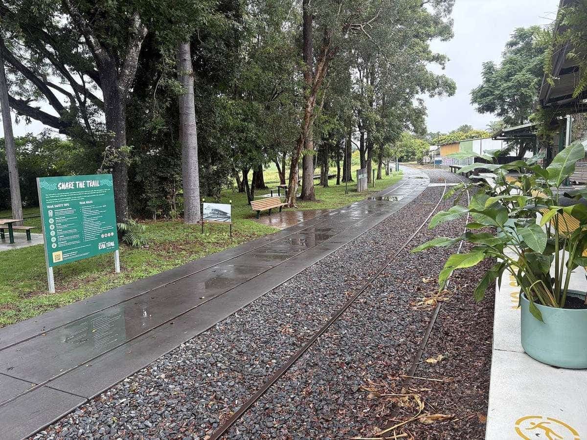
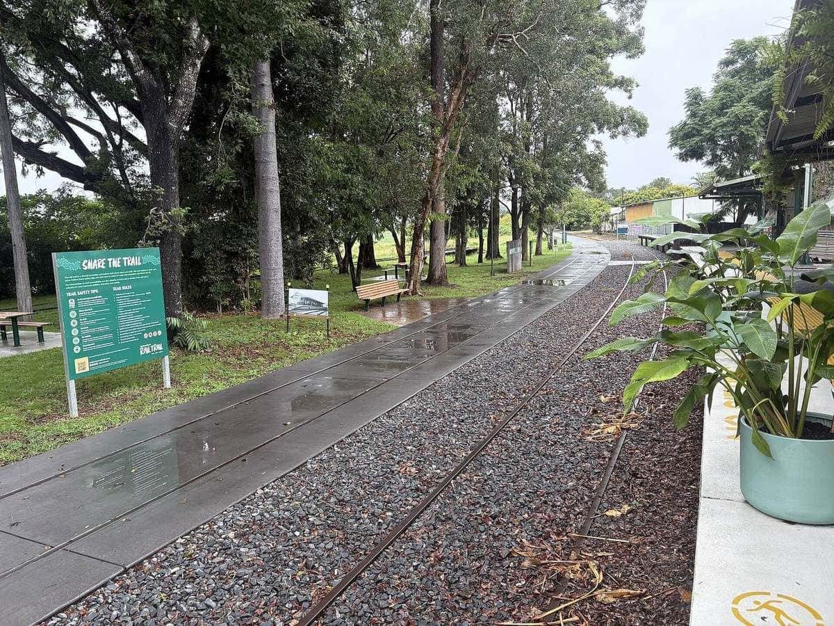
The official cycling page calls the Tweed section an easy, smooth ride for leisure riders and enthusiasts. Surface, in the trail’s own words: sealed asphalt from Murwillumbah Railway Station to the Tweed Regional Gallery and between Burringbar and Mooball Stations; the rest a very solid compacted gravel suitable for riders and mobility devices. Gradient is generally a maximum of 4.5 percent, with shorter, steeper pieces up to 15 percent where pathways bypass bridges.
That combination is why a hybrid or a gravel bike is the versatile choice, and why a skinny road tyre is a gamble on the gravel pieces after rain. A legal e-bike within the 250 W cap is allowed. An e-scooter is not. The FAQ is blunt about motorcycles, trail bikes, quad bikes and cars: not allowed.
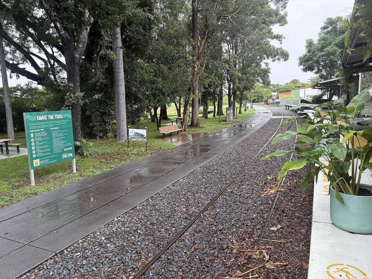
Murwillumbah Railway Station is the northern trailhead in the photographs and in the parking notes. The FAQ lists public parks at the station, asks visitors not to clog Railway Street, and points to Budd Park across the road. Villages along the way — Stokers Siding, Burringbar, Mooball, Crabbes Creek — are the reason the section works as a day ride with coffee, not as a wilderness crossing. Visit NSW mentions 16 heritage railway bridges and the 524-metre Burringbar Range Tunnel. The tunnel is habitat. Treat it that way.
Tunnels, glow worms and lights
The Tweed tunnels are kept dark because they are habitat for microbats and glow worms. That is not folklore; it is how the trail is presented on official pages. Bring a light, keep it pointed at the ground, keep noise down, and follow whatever the current signage says about dismounting. A helmet light that strobes at the ceiling is a wildlife problem. A group that shouts in the portal is a wildlife problem. The ride is the formation, not the Instagram reel.
If you ride the Casino to Lismore section, Visit NSW notes the Naughtons Gap Tunnel. The trail’s cycling page says the first kilometre from Old Casino Station is asphalt, the remainder crushed granite, with a spray seal over that tunnel, and that the approach to the tunnel increases to 15 percent. Same rule: light, quiet, no heroics.
The Casino to Lismore section: 29.7 km
The FAQ’s second number is 29.7 km. That figure is the joined Richmond Valley and Lismore pieces — Destination NSW’s media release described the Lismore to Bentley opening as connecting to the 13.4 km Richmond Valley section that opened in March 2024. The trail cycling page describes the Casino to Bentley width as generally 4 metres, narrowing to 2.5 metres in places, with a maximum grade of 4.5 percent for most of the Richmond section.
This is the quieter inland ride. Old Casino Station is the official start of the Casino to Bentley piece, with toilets, water and bike facilities listed on the FAQ. Lismore Railway Station is the other formal trailhead. The landscape is open countryside, creek crossings and historic bridges rather than a Tweed-village string. It is still not a wilderness route. It is a rail trail through a flood-aware region.
Horses have a dedicated story on this section. The FAQ allows horses on a bridle path parallel to the main trail from Casino to the Back Creek Bridge at Bentley (13.4 km), with a further dedicated path toward Lismore after dismounting to cross that bridge. Bikes give way to horses; horses and bikes give way to pedestrians. If you are not expecting a horse, you are not reading the rules.
What the FAQ actually allows
Official allowed uses, quoted in substance from the FAQ and the safety page:
- bicycles and e-bicycles up to 250 W
- accessibility devices, wheelchairs and mobility scooters
- push scooters and skateboards on sealed sections only
- prams
- dogs on short leads, and you pick up after them
- horses in designated areas only
Official not-allowed list:
- e-scooters or petrol-powered bicycles
- motorcycles, trail bikes, quad bikes, cars or similar
- other motorised recreational vehicles
- horses outside designated areas
- camping on the trail
- smoking or e-cigarettes
- fires and trail-side barbecues
Helmets are required. The FAQ states the trail is a road-related area under the Roads Act 1993. There is no posted speed limit; you ride to conditions. Pedestrians have right of way. Keep left. A metre matters when you pass. Leave no trace. Do not feed wildlife. Do not enter private property.
That is a lot of “no” for a page that is trying to get you to ride. It is also why the Northern Rivers trail is a good first tour: the rules are written down, the sections are short, and the towns still have bakers.
Seasons and BOM
The Northern Rivers is subtropical. Bureau of Meteorology climate statistics for Murwillumbah, Lismore and Casino are the pages to open for mean maxima, humidity and rainfall seasonality. Summer is hot and humid with storm risk. Winter is the comfortable riding season for many visitors, with shorter days. Autumn and spring sit in between.
A practical pattern:
- May to September. The usual touring window if you dislike humidity. Carry a layer for valley mornings.
- October to November. Storms return. Check the afternoon sky.
- December to March. Ride at sunrise or do not ride. Carry more water than the 24 km distance suggests. Heat illness does not care that the grade is 4.5 percent.
- Any month after heavy rain. Check the trail site. Low-level crossings and gravel change character.
School holidays fill Murwillumbah and Lismore beds. We do not quote rates. Book before you assume a station-town pub has a spare room.
Road touring in NSW, and what is not a tour
This site will not publish a Pacific Highway itinerary. A national highway with freight, tourist traffic and narrow shoulders is a way to get a bike from a shed to a trailhead in an emergency, not a holiday. The same is true of the M1 corridor between the Gold Coast and the Tweed.
Quiet country roads in the Northern Rivers hinterland, the Southern Highlands, or the western slopes can be real road touring. They inherit Transport for NSW sharing-the-road rules: drivers must leave at least 1 metre when passing a cyclist where the limit is 60 km/h or less, and 1.5 metres above that. You still ride predictably on the left, wear an approved helmet, and carry lights if daylight is a maybe.
If you want a multi-day sealed path with towns every couple of hours, Victoria’s Murray to Mountains is the documented answer on this site. If you want a longer unsealed rail trail and you can handle heat, Queensland’s Brisbane Valley is next door. NSW’s documented contribution is the two Northern Rivers sections plus the judgement to stay off the highway.
E-bikes, groups and commercial use
The 250 W cap is the trail’s published e-bike rule. A throttle-only scooter is not a touring bicycle here. Charge in town. Range anxiety on a 24 km section is usually a charging-habit problem, not a distance problem, unless you add the gallery climb — the cycling page warns that the connection to the Tweed Regional Gallery is steep and may not suit riders who have to carry a bike.
Private recreational groups of 30 people or fewer do not need a permit, according to the FAQ. Commercial tour operators and groups operating for commercial purposes do. This site does not sell either product and does not list operators. If you want a shuttle or a hire bike, the trail site points to businesses that hold a commercial pass. Ask them about current prices. We will not invent them.
Cycling Without Age is named on the FAQ as operating free trishaw rides on the Tweed section on set weekday mornings between Burringbar and Mooball. That is an official trail note about accessibility, not an advertisement we wrote.
Sample ways to ride NSW
Tweed day, out and back. Murwillumbah station to Burringbar or Mooball and return. Asphalt and compacted gravel. Light for the tunnel. Coffee in a village. This is the first-tour shape.
Tweed one-way. Murwillumbah to Crabbes Creek, 24 km, with a pre-arranged lift back. Do not assume a bus will take a dirty bike at the hour you finish.
Casino to Lismore day. 29.7 km inland. Hybrid or gravel tyres. Expect horses on the parallel bridle path. Start at Old Casino Station or Lismore Station. Wind on open farmland is a bigger problem than gradient.
Two-day Northern Rivers. Tweed one day, Casino–Lismore the next, with a road transfer between the still-unconnected pieces. Do not invent a through-ride on an unfinished corridor.
Road add-on, only if the road is quiet. A hinterland loop from Murwillumbah or a Southern Highlands country-road weekend is road touring. Read the road touring page and the Transport for NSW sharing rules. Skip it if the only line on the map is a highway.
Safety that is specific to this trail
Mobile coverage is uneven. The FAQ says not to rely on it, to download the Emergency Plus app, and to carry a printed or downloaded map. That advice is more important on the inland section than on the Tweed village string, and it is still true on both.
A steel trough conduit runs parallel to parts of the Tweed section. The FAQ says it contains a high-voltage cable transferring electricity between NSW and Queensland. Do not touch it. Stay on the trail.
Snakes are a warm-weather fact in the Northern Rivers. The FAQ’s ashes-scattering notes even mention a snake-bite kit as general trail awareness. Give wildlife space. Do not feed it.
Night riding is technically possible because the trail does not lock. The FAQ’s phrase is “yeah but nah”: recommended hours are sunrise to sunset, shops close, and you must be visible with a light if you ignore that. A first tour should finish in daylight.
How this page connects
Read the Northern Rivers Rail Trail field guide for section narrative. Read tour types if you are still choosing a bike. Read Queensland if you are crossing the border and thinking the Brisbane Valley is a similar day — it is not; it is 161 km of mixed gravel with a heat problem. Read Victoria if you want asphalt for a long weekend.
Destination NSW can tell you the Northern Rivers is a visitor region. The official FAQ can tell you the trail is 24 km plus 29.7 km, e-bikes to 250 W, helmets on, dogs on short leads, no camping on the formation. Ride the open pieces. Check flood. Stay off the highway.
Frequently asked questions
How long is the Northern Rivers Rail Trail?
The official FAQ gives two open-section lengths — 24 km from Murwillumbah to Crabbes Creek and 29.7 km from Casino to Lismore. Visit NSW and Destination NSW describe a planned 132 km trail from Murwillumbah to Casino when remaining sections are built. Ride what is open. Confirm closures after rain on the trail site.
Can I ride an e-bike on the Northern Rivers Rail Trail?
The official FAQ allows bicycles and e-bicycles up to 250 W. E-scooters and petrol-powered bicycles are not allowed. Helmets are required. The trail is treated as a road-related area under the Roads Act 1993.
Is Destination NSW the trail manager?
No. Destination NSW and Visit NSW are tourism context. The trail is collectively managed by the four local councils that make up the Northern Rivers Rail Trail. Tunnels, dogs, horses and closures belong on the official trail pages.
Do I need a light for the tunnels?
Yes if you enter them. Visit NSW notes the 524-metre Burringbar Range Tunnel on the Tweed section, habitat for glow worms and microbats, and the Naughtons Gap Tunnel on the Casino to Lismore section. Follow the trail’s current tunnel rules — keep noise down and treat the dark as habitat, not a race.
Is the Pacific Highway a bike tour?
Not on this site. A quiet Northern Rivers or Southern Highlands back road can be touring. A national highway with freight is a commuting emergency, not an itinerary. Use Destination NSW for region context and Transport for NSW for sharing-the-road rules.
Are helmets compulsory in NSW?
Yes. The trail FAQ says cyclists must wear a helmet. Transport for NSW also sets minimum passing distances for drivers — at least 1 m where the limit is 60 km/h or less, and 1.5 m above that.
Sources and further reading
Facts on this page were checked against these primary and official sources. Conditions change — confirm before you travel or buy.
- Northern Rivers Rail Trail FAQ — Northern Rivers Rail Trail
- Safety and rules — Northern Rivers Rail Trail
- Cycling on the Northern Rivers Rail Trail — Northern Rivers Rail Trail
- Northern Rivers Rail Trail — Destination NSW / Visit NSW
- Lismore to Bentley section set to open — Destination NSW
- Sharing the road — Transport for NSW
- Climate data — Bureau of Meteorology