If you want a first multi-day bicycle tour in Australia and you already own a road bike, Victoria is the state that matches the tyre. Rail Trails Australia lists the Murray to Mountains as 137 km of asphalt. That is the rare Australian rail trail you can ride without swapping to knobs. The second Victorian ride this guide treats in depth is the Great Victorian Rail Trail, which Rail Trails Australia describes as 134 km of compacted earth and fine gravel from Tallarook toward Mansfield. Those two formations are why this destination page exists. Everything else in the High Country is context.
This is a touring page, not a mountain-bike park page. Bright and Beechworth sit near purpose-built downhill and jump networks. Those parks belong on a different site. Here the question is simpler: which official rail-trail length, which surface, which town overnight, and which Bureau of Meteorology climate page you open the week you leave.
137 km
Murray to Mountains
Asphalt listing, Rail Trails Australia
134 km
Great Victorian
RTA body figure; confirm the manager map
Visit Victoria
Tourism context
Not a trail manager
How to use this state guide
Visit Victoria’s High Country cycling pages are useful for the wider region — farmgates, autumn colour, the fact that the north-east is set up for visitors — and they are not the source we use for kilometre counts. The destinations hub already said that. This page repeats it because tourism copy and trail-manager copy disagree in small, important ways. Visit Victoria’s Great Victorian page, for example, still calls that trail Victoria’s longest rail trail and gives 134 km. Rail Trails Australia’s Brisbane Valley listing is 161 km, which is why this site treats the Queensland trail as Australia’s longest. Tourism adjectives are not an inventory.
Use this page to pick a Victorian surface. Then open the field guides:
Then open the official trail site the morning you ride. Formations close after rain and after fire. Rail Trails Australia’s Great Victorian listing, last updated in April 2026 when we checked it, noted that the January 2026 bushfires had closed the Cheviot Tunnel–Alexandra and Merton sections indefinitely, while the tunnel itself was open. That is the kind of fact a destination essay cannot freeze. The manager’s page wins.
Murray to Mountains: the sealed network
Rail Trails Australia places the Murray to Mountains 250 km north-east of Melbourne and lists the start and end as Wangaratta to Bright, Yackandandah and Oxley, plus Rutherglen to Wahgunyah. The surface line is the one that matters: asphalt. The listing says the entire 137 km is sealed, on gentle grades apart from the stretch from Everton up to Beechworth and down to Yackandandah.
That is four branch lines, not one corridor. Rail Trails Australia splits them as:
- Wangaratta to Bright, 82 km, following the Ovens Valley via Everton and Myrtleford. The same listing says this piece splits easily over three days.
- Everton to Yackandandah, 38 km, climbing to historic Beechworth then undulating to Yackandandah.
- Wangaratta to Oxley, 9 km, described as basically flat, toward the King Valley and the Milawa gourmet area.
- Rutherglen to Wahgunyah, 8 km, another flat sealed stretch across the Rutherglen wine-growing area, with an on-road connection from Bowser.
Those numbers are why a “Murray to Mountains weekend” can mean three different rides. A family on hybrids can ride Porepunkah to Bright and back on the valley floor. A loaded tourer can take three days from Wangaratta to Bright and never leave asphalt. A rider who wants a climb can leave the main trail at Everton and go up to Beechworth — Rail Trails Australia calls that one of the steepest grades allowed on a broad-gauge branch line, and suggests some people will find it more peaceful in the opposite direction.
The network has gaps. The RTA listing is explicit: connecting routes may involve riding on roads, including a 42 km on-road option from Bowser toward Rutherglen on 100 km/h roads with no shoulders. That is not a rail trail. It is a road-touring problem, and it belongs under road touring and road rules. Helmets stay on. Hold a line. Assume the shoulder is a suggestion.
What bike on the sealed trail
Because Rail Trails Australia marks the full listing as asphalt, a road bike is a legitimate choice on the formation itself. So is a touring bike, a hybrid, a gravel bike with slick tyres, and a road-legal e-bike. The Beechworth climb is the exception that tests gears, not rubber. If anyone in the group is new to loaded climbing, an e-bike on that branch is a planning decision, not a fashion one. We do not publish hire-fleet prices. Local visitor centres and the trail towns are where you check what is actually available the week you ride.
Prams and wheelchairs appear on the RTA suitability list for this trail. That is a reminder to ride at a shared-path pace through town trailheads, not a claim that every cutting is a boulevard.
Towns that still behave like stations
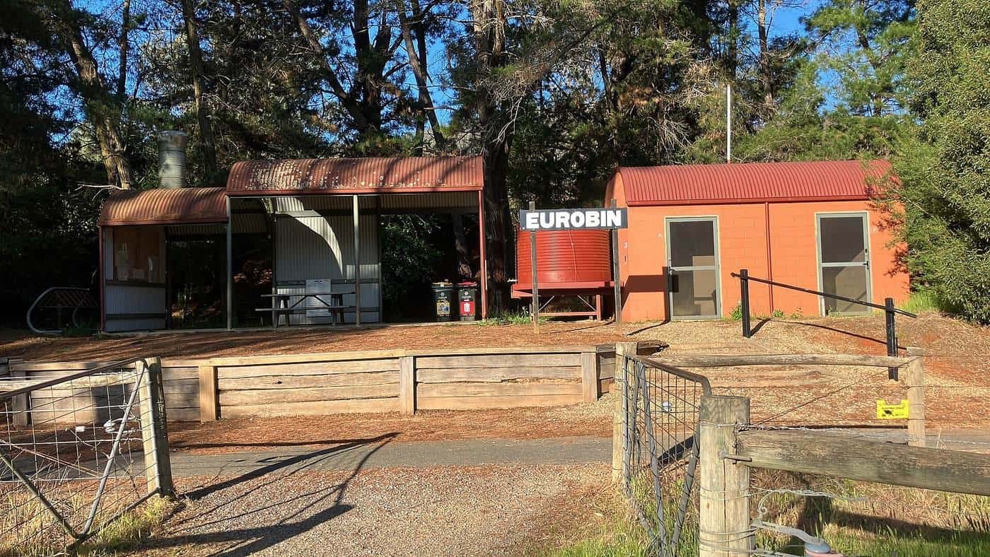
Wangaratta is the regional centre with a train service — Rail Trails Australia lists coach and train as public transport for the trail. Bright is the holiday town at the alpine foothills. Myrtleford sits in the middle of the Ovens Valley piece. Beechworth and Yackandandah are the historic towns on the climbing branch. Rutherglen and Wahgunyah sit on the Murray piece. Those names are on the official listing. We do not invent a fourth bakery or a secret cellar door.
If you plan to taste wine in Rutherglen or Milawa, treat alcohol as a road-rule problem. A bicycle on a road or a road-related area is still traffic. Pace the day so the ride happens before the tasting, or walk.
Great Victorian: the gravel multi-day
Rail Trails Australia places the Great Victorian 90 km north of Melbourne and lists the start and end as Tallarook to Alexandra and Mansfield. The body of that listing calls it 134 km. The header on the same page currently shows 135 km. This site uses 134 km, matching the body text and Visit Victoria’s Great Victorian page, and tells you to confirm the manager’s map before you treat a day as exact.
The surface is compacted earth and fine gravel. Horses share parts of it; arrows mark dedicated bridle turn-offs. That is why a 28 mm road tyre is the wrong opening move. A hybrid, gravel bike or touring bike with wider rubber is the tool. After rain, granitic sand behaves like wet sugar. After a dry January, it corrugates. Check the official trail site, not this paragraph.
Rail Trails Australia’s main sections, with the listing’s own kilometre splits, are:
- Tallarook to Yea, 38 km, up the Trawool Valley, which the listing notes is classified by the National Trust for its scenic beauty.
- Yea to Yarck, 28 km, featuring the Cheviot Tunnel and Goulburn River floodplains.
- Yarck to Bonnie Doon, 33 km, including the highest point on the trail at Mertons Gap.
- Bonnie Doon to Mansfield, 23 km, with the bridge over Lake Eildon and views of Mount Buller.
- Cathkin to Alexandra, 13 km, on the former spur line, with a climb to Eglington Gap.
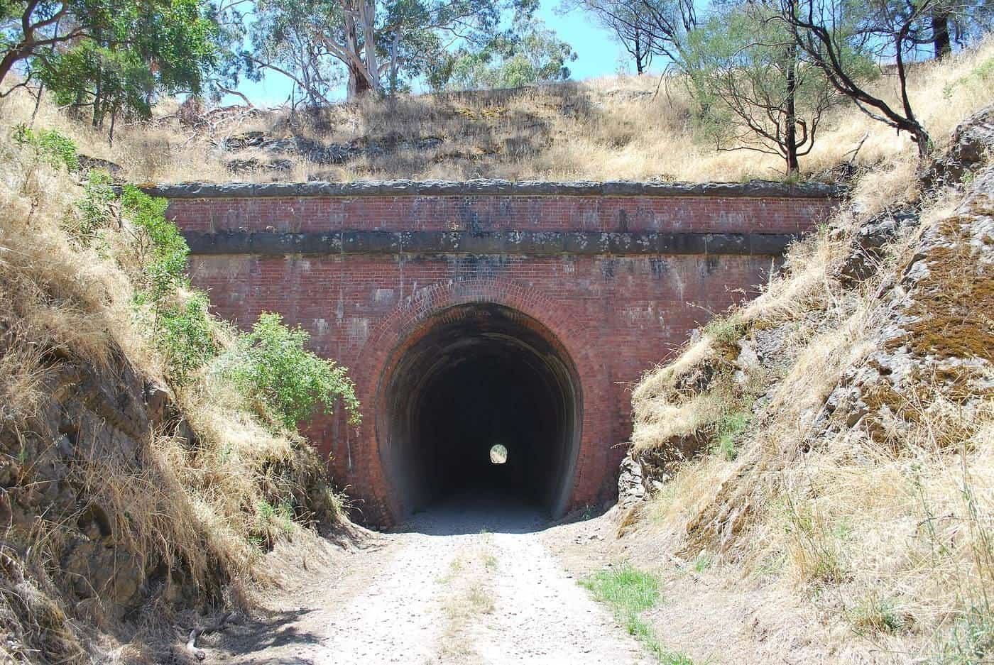
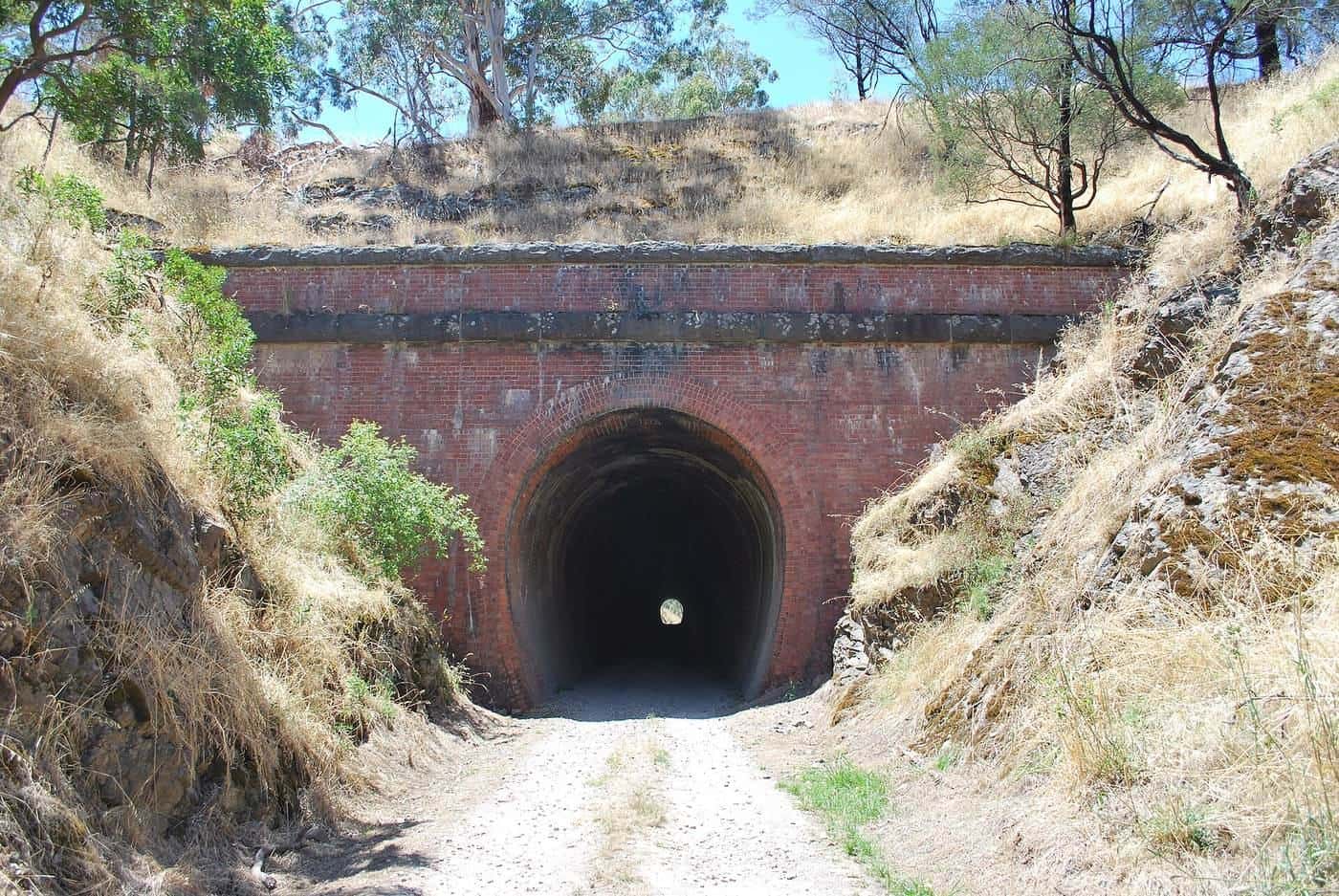
The Cheviot Tunnel is the only tunnel on a Victorian rail trail in that listing. Rail Trails Australia describes it as about 200 m, straight, and quite dark in the middle: use a headlight or dismount. The Bonnie Doon crossing is a 385 m bridge over the Brankeet Arm of Lake Eildon. Those two structures are why people photograph this trail. They are not why you should skip the fire-closure check.
Tallarook is a small town with limited facilities but it sits on the Seymour rail line. Yea is the medium town with food and beds. Mansfield is the High Country tourist centre at the eastern end. Alexandra is the spur-line town. Book beds before you romanticise a three-day itinerary; this site does not invent availability.
Visit Victoria as context, not gospel
Visit Victoria’s High Country cycling overview talks about “over 300 kilometres of popular rail trails” in the region and points visitors at the Murray to Mountains, the Great Victorian, and a shorter High Country Rail Trail around Lake Hume. That is useful regional colour. It is not a substitute for Rail Trails Australia’s trail-by-trail inventory, and it is not a reason to stitch three formations into one unsupported day.
This guide does not invent a kilometre count for every other Victorian rail trail. If you want the High Country Rail Trail along Lake Hume, open the trail manager and Rail Trails Australia for that listing. If you want the Bellarine, the East Gippsland, or a local shared path out of Melbourne, do the same. The two trails above are the ones this site has documented to field-guide depth.
Seasons, frost and fire
North-east and north-central Victoria are not a single climate. The Bureau of Meteorology publishes climate statistics for towns on both trails — Wangaratta, Bright, Yea, Mansfield and Seymour among them. Use those pages for mean maxima, frost nights and rainfall, then layer the forecast the week you ride.
A practical touring pattern, without pretending it is a guarantee:
- Spring. Growth, lambs, and a chance of late frost on shaded gravel. Good first-tour weather if you carry a layer.
- Summer. Hot valley afternoons. Ride early. Check the fire danger rating and any total fire ban. Forested approaches and High Country grasslands are not a place to prove toughness on a catastrophic day.
- Autumn. The reason Bright photographs well. Still check fire restrictions in a dry March.
- Winter. Frost, fog, and short daylight. The sealed Murray to Mountains stays rideable for locals in winter kit. The Great Victorian’s shaded cuttings can hold ice. Lights help in the Cheviot Tunnel in any month.
School holidays and ski season change bed availability in Mansfield and Bright. That is a booking problem, not a trail-surface problem. We do not quote room rates.
Road rules when you leave the formation
Almost every Victorian rail-trail day includes a road: the ride from the station, a highway crossing, a pub on the far side of the highway, or the on-road Rutherglen connection. Cyclists follow the road rules. Helmets are compulsory. Lights and a bell belong on the bike before you need them in a tunnel or a late arrival.
Passing-distance laws and footpath rules are state-specific and they change. Read road rules and safety and then the current Victorian page, not a memory of New South Wales. Ride on the left. Hold a predictable line so a driver can give you space.
Emergency marker posts appear on both major trails. Rail Trails Australia notes ESTA markers on the Murray to Mountains (codes such as MTM111) and at one-kilometre intervals on the Great Victorian (codes such as GVR22). In an emergency, call 000 and quote the nearest code. That is more useful than a phone screenshot of a pretty cutting.
Sample ways to split the days
These are starting points, not products. Adjust them to your pace and to whatever the manager has open.
Sealed long weekend, Wangaratta to Bright. Day one Wangaratta to Myrtleford on the 26 km Everton piece plus the 26 km into Myrtleford, or a gentler split with a night at Everton if you can find a bed. Day two Myrtleford to Bright, 30 km up the Ovens Valley with Mount Buffalo on the right. Add a third day for the Beechworth climb if the group wants historic streets more than valley kilometres.
Sealed out-and-back for mixed bikes. Porepunkah to Bright and back. Same asphalt, bakery at one end, river at the other. This is how you test whether a child or a new e-bike rider enjoys the surface before you book three nights.
Gravel two-day, if the western Great Victorian is open. Tallarook to Yea through the Trawool Valley, then Yea to the Cheviot Tunnel and back to Yea. Carry a light for the tunnel. Do not continue into a posted closure.
Gravel lake day, if Bonnie Doon to Mansfield is open. The 23 km piece with the 385 m lake bridge. Hybrid or gravel tyres. Wind on the water is a different problem from gradient.
Wine-country add-on. The 8 km Rutherglen–Wahgunyah sealed piece is a morning, not a tour. Pair it with walking between cellar doors if you intend to taste. Do not invent a supported luxury product from that sentence.
E-bikes, luggage and support
A legal e-bike flattens the Beechworth branch and the Mertons Gap climb. It does not change the gravel. Charge overnight in town; do not assume a trailhead tap is a powerpoint. This site does not rank operators. If you want luggage moved between towns, that is a self-guided product you buy from someone who actually runs a van — read self-guided versus guided for the trade-offs, then ask the operator the questions on that page. We do not take a commission for naming a town.
Independent riders can credit-card tour both trails: a day bag, a booked bed, a pie in the next town. Fully loaded panniers work on the sealed Murray to Mountains and on the firmer Great Victorian pieces. Soft sand after rain is when a heavy touring load becomes a hike-a-bike. Pack for the surface you verified that morning.
What not to do in Victoria
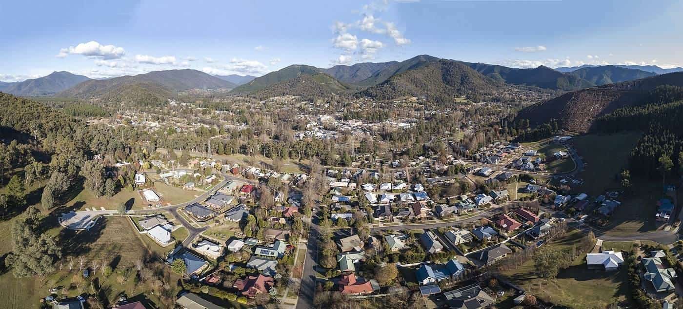
Do not treat Bright as a downhill destination on this site. The town photograph on this page is a valley town at the foot of forested mountains. The rail trail ends at a station precinct. The mountain-bike parks are a different sport.
Do not stitch the Murray to Mountains to the Great Victorian in a single unsupported day because they share a “High Country” tourism brand. They do not share a formation. The road between them is a separate touring problem.
Do not ignore a fire closure because a blog from 2019 showed the Merton section in spring grass. The January 2026 fires are why Rail Trails Australia’s listing carried a partial-open warning when we read it.
Do not ride the Bowser–Rutherglen on-road link at dusk and call it a rail trail. Kangaroos, 100 km/h limits and no shoulder are a road-touring combination.
How this page connects
The destinations hub is the state menu. This page is the Victorian chapter. The two field guides underneath it carry stage detail. Tour types tells you whether you want sealed, gravel or an e-bike. Planning is for the week-of-the-year problems — frost, fire, school holidays. What to pack assumes you can buy bread in Yea or Bright.
If you are choosing between states, New South Wales’s documented ride on this site is the Northern Rivers Rail Trail in shorter official sections. Queensland’s Brisbane Valley is longer and hotter. Victoria remains the sealed first answer.
Ride on the left. Carry water. Cite Rail Trails Australia for the kilometre count, Visit Victoria for the region, and the Bureau of Meteorology for whether the valley will cook you at 2 pm.
Frequently asked questions
What is the best first multi-day bike tour in Victoria?
The Murray to Mountains Rail Trail. Rail Trails Australia lists it as 137 km of asphalt linking Wangaratta, Myrtleford, Bright, Beechworth and Yackandandah, plus sealed pieces to Oxley and between Rutherglen and Wahgunyah. A road bike, hybrid or legal e-bike all make sense. Confirm current surface and the Beechworth climb with the trail manager before you treat a day as exact.
How long is the Great Victorian Rail Trail?
Rail Trails Australia describes it as 134 km from Tallarook toward Mansfield, with a branch to Alexandra. The same listing’s header currently shows 135 km, so use the manager’s map for day splits. The surface is compacted earth and fine gravel, not a road-bike path.
Is Visit Victoria the trail manager?
No. Visit Victoria is the state tourism body and is useful for High Country region context. Lengths and surfaces on this page come from Rail Trails Australia. Closures belong on the official trail sites.
Can I ride a road bike on Victorian rail trails?
On the Murray to Mountains listing, yes — Rail Trails Australia marks the full 137 km as asphalt. On the Great Victorian, no. That listing is compacted earth and fine gravel. Narrow road tyres belong on the sealed path, not on granitic sand after rain.
Are helmets compulsory in Victoria?
Yes. Bicycle helmets are required in every Australian state. Austroads summarises national practice; check the current Victorian road rules before you ride on roads between trailheads.
When should I ride in north-east Victoria?
Spring and autumn are the usual touring windows. The Bureau of Meteorology climate pages for Bright, Wangaratta, Yea and Mansfield are the source for heat, frost and rainfall, not Instagram captions. Check fire danger in summer and frost on shaded gravel in winter.
Sources and further reading
Facts on this page were checked against these primary and official sources. Conditions change — confirm before you travel or buy.
- Murray to Mountains Rail Trail — Rail Trails Australia
- Great Victorian Rail Trail — Rail Trails Australia
- Cycling trails, High Country — Visit Victoria
- Great Victorian Rail Trail — Visit Victoria
- Climate data — Bureau of Meteorology
- Bicycle helmet exemptions — Austroads