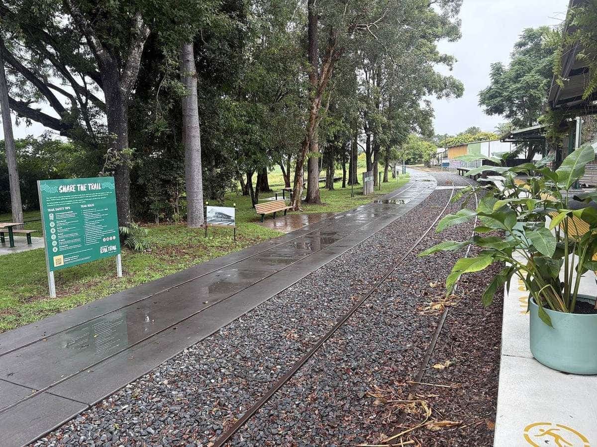
Queensland on this site is a gravel problem with a heat problem, and the gravel happens to be Australia’s longest rail trail. Rail Trails Australia lists the Brisbane Valley Rail Trail at 161 km, from Wulkuraka in the City of Ipswich to Yarraman on the Great Dividing Range. Tourism and Events Queensland, writing on queensland.com, uses the same length and the same “longest recreational rail trail” claim. That is the rare case where the tourism page and the inventory agree on the number. They still do not agree on what you should ride: TEQ is context for the region; Transport and Main Roads is the manager you check for closures and events.
This is not a tropical-island brochure and it is not a mountain-bike park guide. South East Queensland summers are hot and humid. The Bureau of Meteorology is the climate source. If you want a sealed first tour, go to Victoria. If you want a short subtropical day, go to the Northern Rivers. If you want 161 km of mixed gravel through country towns, stay here and split the trail into pieces you can actually finish before the afternoon cooks you.
161 km
Brisbane Valley
Rail Trails Australia; TEQ agrees
Wulkuraka–Yarraman
Ends
Sea level to about 500 m on the range
Heat
Summer constraint
Check BOM, ride at dawn
Tourism and Events Queensland as context
Queensland.com’s rail-trail page is useful for the story of the old Brisbane Valley railway — timber, milk and beef toward Brisbane — and for naming the towns a visitor will actually recognise. It is also useful for the reminder that you can ride the whole 161 km or a few sections. It is not useful as a live conditions feed, and it is not a price list. Where that page names a commercial shuttle or hire desk, treat the name as tourism inventory, not as a recommendation from this site. We do not sell tours and we do not invent rates.
The Department of Transport and Main Roads publishes an events page for the corridor and requires permits for organised groups. That is the manager’s voice. If you are twenty friends on a Saturday, read that page before you assume the formation is your private gran fondo.
The 161 km in official pieces
Rail Trails Australia’s listing is the skeleton we use. The trail starts near sea level in North Ipswich and finishes around 500 m above sea level at Yarraman. Terrain is gently undulating farmland in the south and steeper, more forested country in the north. Surfaces vary: coarse gravel, compacted earth, fine gravel, and sealed or concrete pieces through towns. The listing is explicit that some sections need an off-road bike and competency on unsealed surfaces. Sections can close after high rainfall. Cattle may graze beside the trail. Low-level crossings exist where bridges are missing. Horses must be shod. Drinking water and toilets are described as available in the towns — which is not the same as a tap every five kilometres.
The listing’s own section splits, summarised rather than copied:
Ipswich to Fernvale, 23 km. Concrete on the first piece and the Brassall Bikeway connection, then gravel and dirt. Former station sites are marked. Fernvale has a visitor information centre at the station site.
Fernvale to Lowood, 8 km. Mainly fine compacted gravel, with concrete through parts of both towns. This is the gentle introduction, the piece people ride with children and hybrids. Views of the Brisbane River. A fun run is held on the trail each July, according to the listing.
Lowood to Esk, 36 km. Coarser gravel and dirt through bush and farmland. The Lockyer Creek Bridge — a large structure the listing gives as 92 m — opened to trail users in 2019. Coominya is limited. Esk is the major regional centre, with the trail crossing the Brisbane Valley Highway in town.
Esk to Toogoolawah, 19 km. More coarse gravel and undulating farmland. Both towns have cafes that open onto the trail, according to the listing.
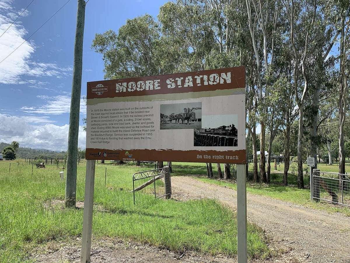
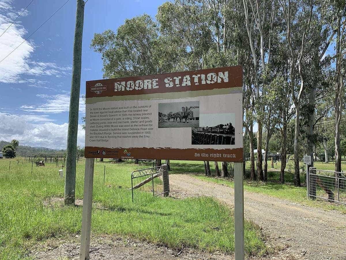
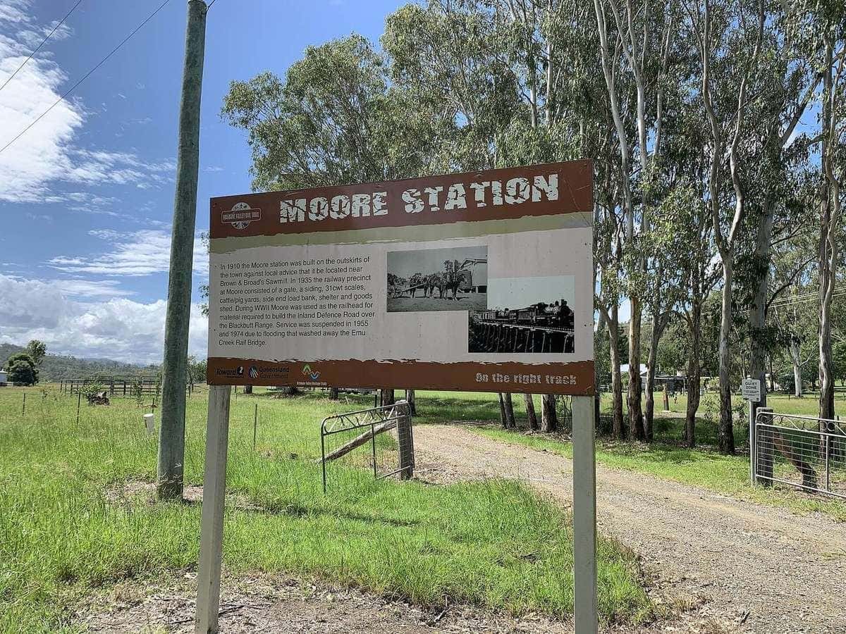
Toogoolawah to Moore, 27 km. Smoother gravel. Steep dips where bridges have been removed. Near Harlin, the Yimbun Tunnel, about 100 m, is the only tunnel on the trail. A large bridge destroyed in the 2013 floods still forces a diversion through Harlin.
Moore to Blackbutt, 29 km. Three sub-pieces. The scenic argument lives here. From Linville the trail climbs the Blackbutt Range — the listing calls it about 20 km with around 300 m of elevation gain, on formation, at railway gradient. Front suspension and gloves are recommended because the surface is rough. Benarkin sits at the top of the range around 500 m.
Blackbutt to Yarraman, 19 km. The listing’s warning is the one to believe: this is the roughest section, with washouts, sand, loose surface and water in creek crossings. It is described as an “adventure trail” piece. Only attempt it on a suitable off-road bike with the skills to match.
A signposted link trail from Yarraman toward the Kingaroy–Kilkivan Rail Trail is mentioned as a connecting path. This site has not written that corridor to field-guide depth. If you want it, open Rail Trails Australia for that listing.
What bike, and what is not a bike for this trail
A road bike with narrow tyres is a mistake on the BVRT as a whole. You might survive the concrete in Ipswich and the granite around Fernvale. You will not enjoy the coarse gravel, the creek dips, or the Blackbutt-to-Yarraman adventure piece. Hybrid, gravel or mountain-bike rubber with tread is the tool. An e-bike that stays within Queensland’s legal power-assisted bicycle definition is common in the towns — the RTA listing notes charging at many hospitality providers — but a motor does not fix a skinny tyre or a closed flood crossing.
Horses share the corridor. Slow down, speak, give room. Walkers share it too. This is not a timed descent.
Heat, BOM and why January is a planning decision
South East Queensland heat is the reason this page exists as a destination warning as well as a trail menu. Open the Bureau of Meteorology climate pages for Ipswich, Esk and a South Burnett town such as Kingaroy or the nearest published site to Blackbutt and Yarraman. Look at mean daily maxima in December, January and February, then look at humidity. Then look at the seven-day forecast the week you intend to ride.
A loaded bicycle on unshaded gravel at 2 pm in a South East Queensland summer is a heat-illness problem. This is not medical advice. It is a reason to:
- start at first light
- sit out the early afternoon in a town
- carry more water than the next-town distance suggests
- wear sun protection that still lets you sweat
- abandon the day if the forecast is a severe heatwave
The heritage page at /motorcycle-tours-thailand/ exists because this domain once sold warm-climate motorcycle tours. It now points at the same Queensland heat problem. BOM is the citation there too.
Winter and the dry shoulder seasons are the usual touring windows for visitors who are not acclimatised. Summer is when locals ride at dawn and visitors should have a good reason.
Rain, flood and fire
Rail Trails Australia says sections can close after high rainfall. Low-level crossings are part of the design where bridges are gone. Never ride through floodwater. The Brisbane Valley is a river valley with a flood memory — Lowood’s flood-boat memorial is on the listing for a reason.
Fire danger is a summer companion in the northern, more forested pieces. Check the rating and any park or trail closures. Smoke is a reason to stay in town.
Towns, food and the thing we will not do
The official listing names the towns: Fernvale, Lowood, Coominya, Esk, Toogoolawah, Moore, Linville, Benarkin, Blackbutt, Yarraman. It says accommodation and food outlets are available in the towns and villages. It does not give us permission to invent a tariff, a shuttle timetable, or a “best bakery” ranking.
Esk is the obvious overnight on the southern half. Blackbutt or Yarraman is the obvious overnight on the range. Linville is the small village at the bottom of the long climb, with a pub the listing calls popular. Book before a weekend. School holidays are not theoretical.
Wulkuraka is on the Ipswich rail network. That is the public-transport gift at the southern end. Yarraman is not a Brisbane commuter station. A one-way ride needs a pre-arranged lift, a coach that actually takes bikes, or a friend. We do not publish a live shuttle roster.
Sample ways to split 161 km
Family or first-day piece. Fernvale to Lowood and back on the fine gravel and concrete. Picnic in either town. This is how you learn whether the group likes unsealed rail trail.
Southern weekend. Wulkuraka to Esk over two cool mornings, including the Lockyer Creek Bridge. Hybrid or gravel tyres. Highway crossing in Esk with your brain on.
Range weekend. Moore or Linville to Blackbutt or Yarraman. Railway-grade climb, rough surface, gloves. Not a road-bike day. Start early even in winter if you want lunch at the top without rushing the creek dips.
Full trail, several days. South to north means the climb arrives later. North to south means more descent on the range and a hotter valley if you finish in summer. Either way, treat it as sections with beds, not as a 161 km statement. Use the field guide and then the TMR and council notices.
Do not. Do not start at 10 am in January from Toogoolawah with one bottle. Do not ride the Blackbutt–Yarraman adventure piece on 25 mm slicks because “it is a rail trail”. Do not assume a missing bridge is a creek you can charge.
Road rules off the formation
Helmets are compulsory in Queensland. The trail crosses roads and, in Esk, a highway. Cyclists follow the road rules on those crossings. Lights help in the Yimbun Tunnel and on a late run into town. A bell is courtesy on a shared corridor and a legal warning device on the road.
If you add a sealed-road day around Ipswich or the Sunshine Coast hinterland, that is road touring, and it is a traffic problem. This page will not invent a coastal highway itinerary.
E-bikes and support
An e-bike makes the Blackbutt Range climb available to more knees. It does not make the rough northern surface smooth, and it does not create water. Charge in town. Carry a spare tube that fits your actual tyre. If you want luggage moved, that is a commercial service you buy from someone who holds whatever permit TMR requires. Read self-guided versus guided. We do not take bookings.
How this page connects
The Brisbane Valley field guide is the narrative companion. Tour types is the bike-choice menu. Planning is the season and water maths. The heritage URL /motorcycle-tours-thailand/ is the warm-climate essay that used to sell motorcycle tours and now tells the same BOM story.
If you are choosing a first Australian rail trail and you own a road bike, Queensland is the wrong first answer. If you own a gravel bike, you can handle humidity, and you like country pubs more than alpine towns, the BVRT is the long one. Cite Rail Trails Australia for 161 km. Cite TEQ for the region. Cite TMR for the closure. Cite BOM before you pick January.
Frequently asked questions
How long is the Brisbane Valley Rail Trail?
Rail Trails Australia lists it at 161 km from Wulkuraka in Ipswich to Yarraman. Tourism and Events Queensland’s queensland.com rail-trail page uses the same 161 km figure and calls it Australia’s longest recreational rail trail. Confirm current surface and closures with the Department of Transport and Main Roads.
Can I ride a road bike on the Brisbane Valley Rail Trail?
Not as a plan. Rail Trails Australia lists a mixed surface of coarse gravel, compacted earth, fine gravel and sealed town pieces, and says some sections need an off-road bike. The Blackbutt to Yarraman piece is described as the roughest. Bring a hybrid, gravel or mountain bike with tread.
Who manages the trail?
Queensland’s Department of Transport and Main Roads manages organised events and day-to-day corridor issues, working with Ipswich City, Somerset, South Burnett and Toowoomba Regional Councils. Tourism and Events Queensland is tourism context, not the trail manager.
Is summer a good time to ride in South East Queensland?
Only if you ride at dawn and treat heat as the main risk. Open the Bureau of Meteorology climate pages for Ipswich, Esk and the South Burnett, then the forecast the week you leave. Heat illness arrives faster than the next town on a loaded bike. This is not medical advice; it is a reason to start early or wait for a cooler month.
Which section is gentlest?
Rail Trails Australia describes the Fernvale to Lowood piece as mainly fine compacted gravel, with concrete through parts of Fernvale and Lowood, and suitable for hybrid bikes. The climb from Linville onto the Blackbutt Range is a different day — the listing calls it a long steady railway-grade climb of around 300 m over about 20 km.
Are helmets compulsory in Queensland?
Yes. Bicycle helmets are required in every Australian state. Road rules still apply when you leave the formation to buy a pie or cross the Brisbane Valley Highway in Esk.
Sources and further reading
Facts on this page were checked against these primary and official sources. Conditions change — confirm before you travel or buy.
- Brisbane Valley Rail Trail — Rail Trails Australia
- How to explore the rail trails of Queensland — Tourism and Events Queensland
- Brisbane Valley Rail Trail events — Department of Transport and Main Roads
- Climate data — Bureau of Meteorology
- Bicycle helmet exemptions — Austroads