Western Australia’s touring answer on this site is a forest path with a Noongar name, not a sealed rail trail and not a jump line. The Munda Biddi Trail Foundation’s about page gives the length we cite: 1,072 km of off-road adventure trail from Mundaring, in the hills east of Perth, to Albany on the Southern Ocean. Munda Biddi means “path through the forest” in the Noongar language of the south-west. That is the sport. Downhill parks, dirt jumps and bike-park shuttle laps belong elsewhere.
Tourism Western Australia is useful for the broader south-west visitor story — forests, coast, towns that still have bakeries. The Department of Biodiversity, Conservation and Attractions (Parks and Wildlife Service) is the land manager. The Foundation is the trail voice for route, shelters and the riding window. When those three disagree about a closure, the park alert wins.
1,072 km
Foundation length
Mundaring to Albany
12
Purpose-built shelters
Foundation: every 40–60 km
Late Mar–Nov
South-west window
Foundation; northern jarrah can exceed 40°C
Foundation length, DBCA rounding, and why we show both
The Foundation’s about page is unambiguous: 1,072 km. DBCA’s Explore Parks trail page has described the same corridor as winding its way for 1,000 km between Mundaring and Albany. This site quotes the Foundation figure, notes the rounded parks figure, and tells you to ride the current official maps. We do not invent a third number to split the difference.
DBCA also says the trail cannot stay entirely in parks. It uses purpose-built singletrack, existing and rehabilitated forest tracks, local-government reserves, and some unsealed and sealed public roads. That last clause is why Western Australian road rules still matter on an “off-road” holiday. Helmet on. Lights if you are caught out. The Road Safety Commission’s bicycle-rider page is the state source.
What kind of trail this is
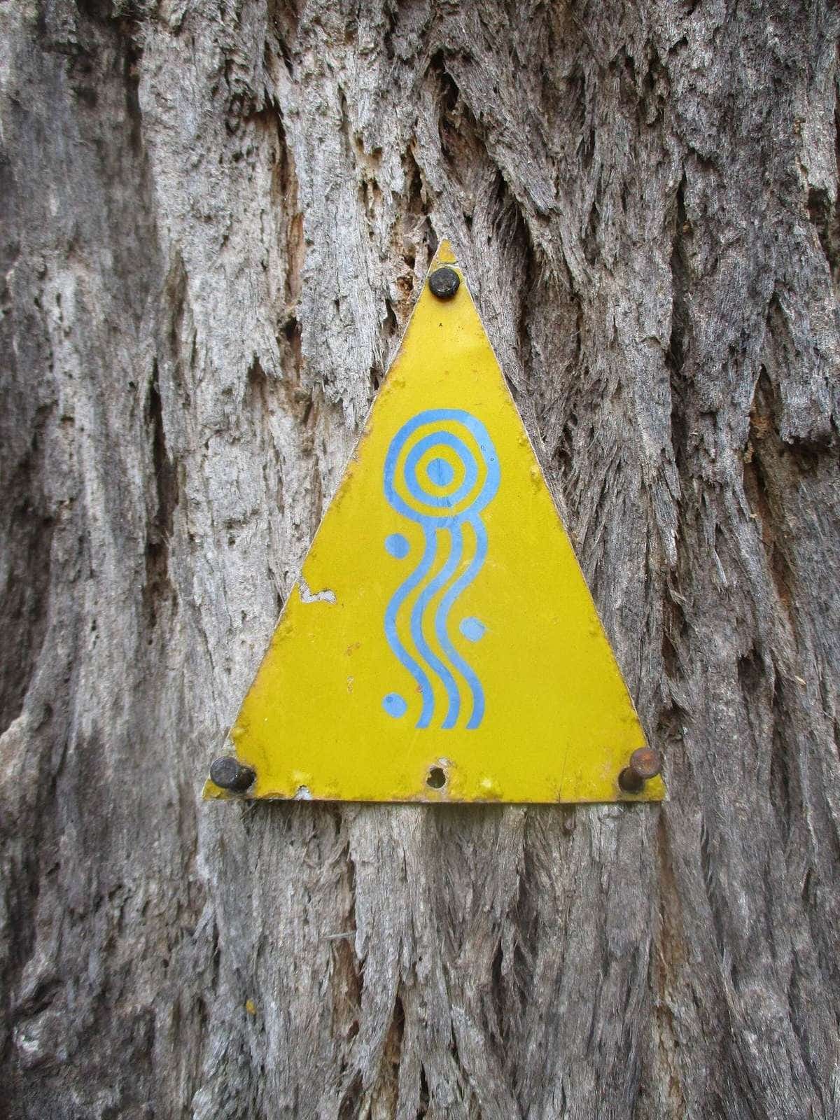
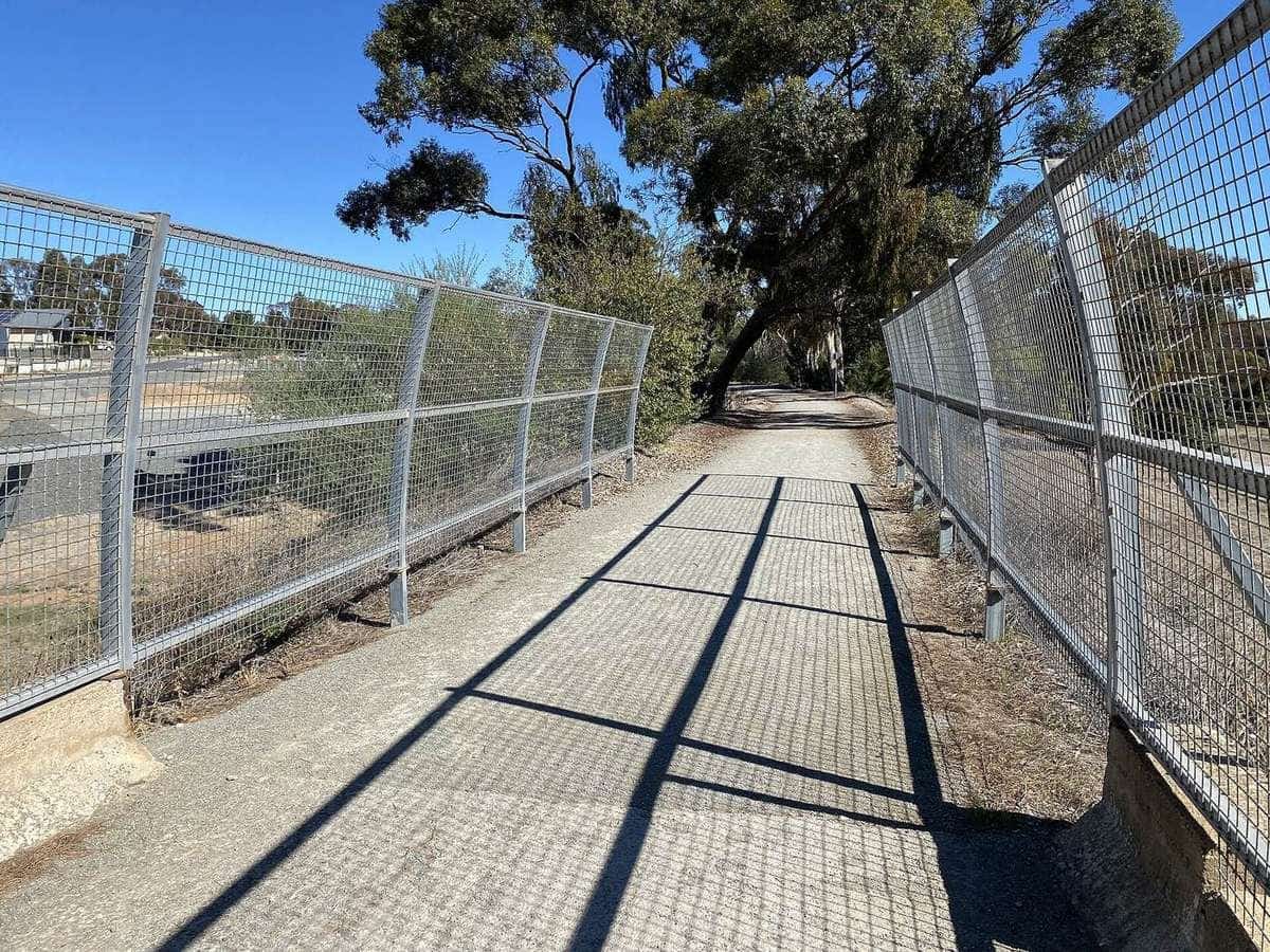
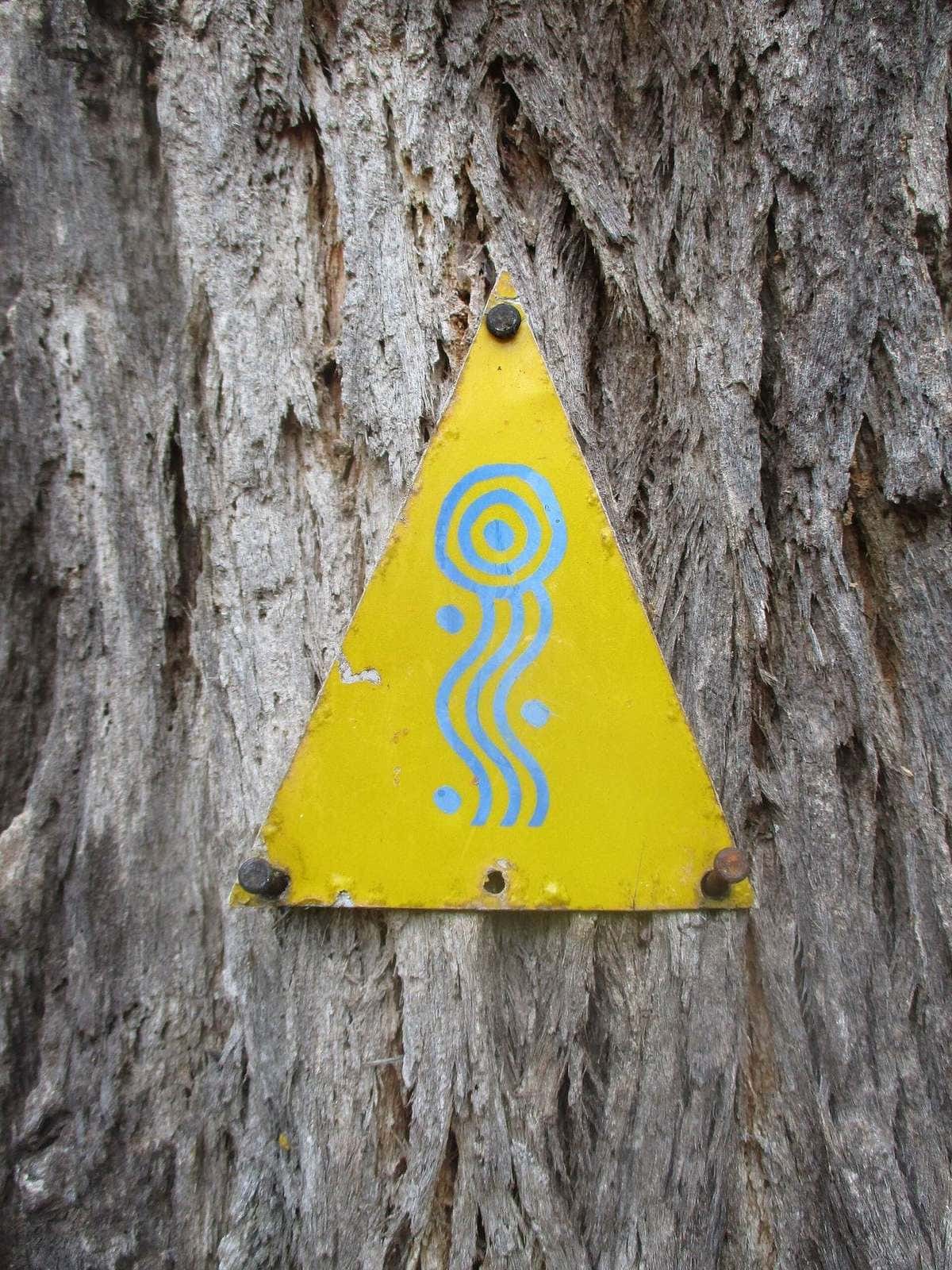
The Foundation calls it a unique off-road adventure cycling and bikepacking trail. You are mostly away from motorised vehicles and busy highways. Terrain varies: rail-trail sections, singletrack and forest roads. The northern section from Mundaring to Manjimup is distinctive red pea-gravel. The southern run toward Albany mixes loamy soils and fine white sand. Choose a section that matches fitness and skill. The Foundation’s own sentence is the one we repeat: to really enjoy the trail, some mountain-biking or gravel-biking experience is recommended.
That recommendation is why this destination page is honest about beginners. A first multi-day ride in Australia, if you only own a road bike, is still Victoria’s sealed Murray to Mountains. A first multi-day ride in Western Australia, if you already ride dirt, is a Foundation-described section with a town at each end. The whole 1,072 km is a expedition.
Shelters, towns and the 40–60 km rhythm
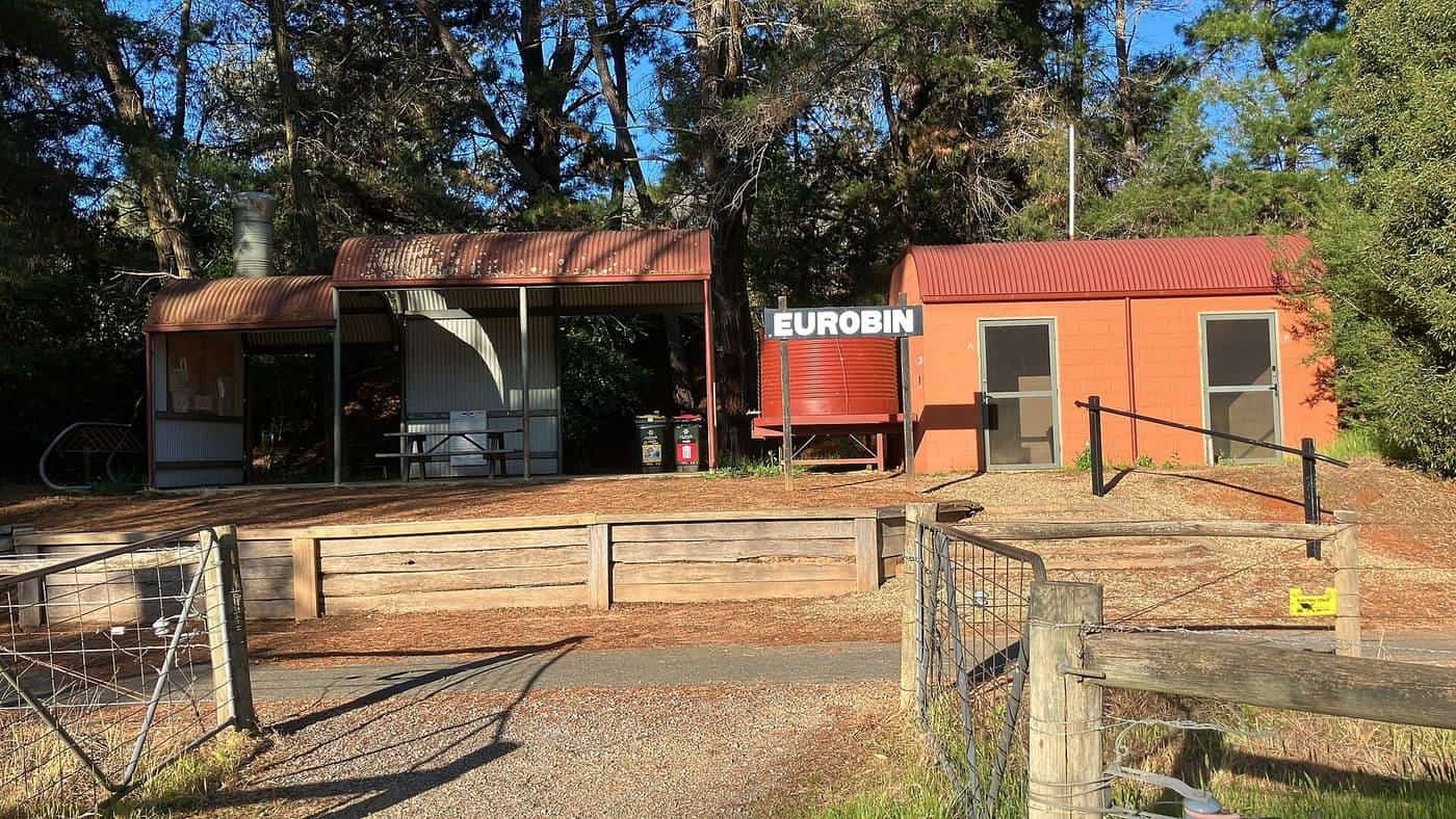
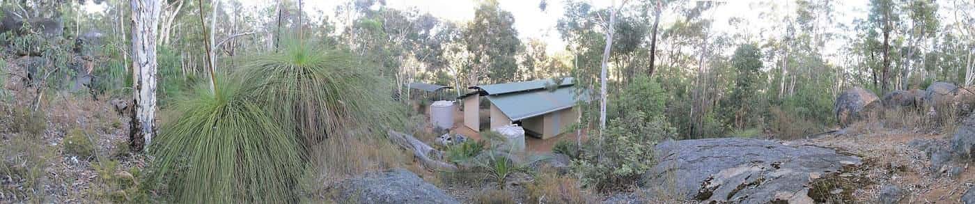
The Foundation describes a series of 12 purpose-built shelters nestled in the forest between country towns, every 40–60 km. The campshelters carry Noongar names. Each has a shelter with sleeping bunks, two water tanks, picnic tables, tent sites, a toilet and bike storage. They are fire-pit free — pack a fuel stove and warm clothing. Camping is a designated-site problem, not a anywhere-in-the-jarrah problem. Confirm current rules on the DBCA and Foundation pages before you treat a clearing as a bed.
Towns are the resupply. Names that appear across Foundation and parks material include Mundaring, Jarrahdale, Collie, Manjimup, Northcliffe, Walpole, Denmark and Albany. Mix shelter nights with town nights if you want a shower and a shop. We do not publish a secret third hut.
DBCA asks groups on organised non-commercial expeditions to notify Parks and Wildlife in advance (the threshold and form live on the parks site). Commercial activity needs a commercial licence. This site does not run either.
The late-March-to-November window
The Foundation’s climate sentence is specific: the window of cycling weather is generally good between late March and November in the south-west, although summer in the northern jarrah forests can get extremely hot (over 40 degrees). That is the planning spine. The Bureau of Meteorology climate pages for Perth, Collie, Manjimup, Walpole and Albany will show you why the south coast is a different summer from the Perth Hills.
A practical reading, without pretending it is a guarantee:
- April to June. Often the start of the comfortable season; the south gets wetter as winter arrives.
- July to August. Rideable, cold, muddy, short days. Creek crossings change character.
- September to November. The other sweet spot, with wildflowers in the biodiversity hotspot the Foundation mentions — and still a fire-planning problem in a dry spring.
- December to March. The Foundation’s hazard window in the northern forests. Heat and fire. Do not prove a point on a 40-degree pea-gravel day.
Prescribed burning is a year-round DBCA program. Diversions happen for improvements, trail damage, flooding, forestry and bushfire. The Foundation’s navigation advice is to treat DBCA park alerts, DBCA safety information, Emergency WA and BOM as primary sources, and to ride the marked diversion even if your downloaded file is a week old.
Tourism WA as context
Westernaustralia.com and the Destination Perth / Australia’s South West region brands are how visitors first hear that the south-west has forests and a coast. They are not a substitute for the Foundation’s 1,072 km, the shelter spacing, or a parks alert. Use tourism pages to decide whether you want to be in the south-west at all. Use the Foundation and DBCA to decide whether you can be on the trail on Thursday.
This site will not invent a second WA rail-trail inventory. If you want a sealed path around the Swan River or a local rail trail near a regional town, open Rail Trails Australia and the relevant council. Those rides are real. They are not documented here to field-guide depth.
What to ride, and what not to bring
A mountain bike or a sturdy gravel bike with wide tyres is the usual tool. Bikepacking bags often handle rough track better than heavily loaded panniers, because the weight stays in the triangle. That is a handling note, not a shopping list. We do not invent test results.
A road bike is a mistake. Fine white sand in the south will explain why. Pea-gravel corrugations in the north will explain why. A legal e-bike may be useful on a short town-to-town section if the current trail rules and your battery plan agree; it is a poor match for a week of shelter nights without reliable charging. Confirm e-bike rules with the Foundation and DBCA before you assume a motor is welcome on every reserve.
Navigation is markers plus official maps plus the trail app. The Foundation and DBCA both warn against treating random online files as current. Mobile coverage dies in the forest. A personal locator beacon or satellite messenger is remote-touring hygiene. Leave a trip plan.
Sample ways to tour Western Australia
Town-to-town weekend. Pick a Foundation section with a bed at each end — for example a Jarrahdale or Collie based pair of days — and ride lighter than an end-to-end kit. This is the beginner-in-WA shape.
Shelter night, then town. One 40–60 km piece into a campshelter, then into a town for resupply. Test water, stove and warm clothing before you chain shelters.
South-coast cooler-season piece. Northcliffe or Walpole toward Denmark and Albany, loam and sand, wind off the ocean. Check BOM coastal forecasts. Sand will punish a narrow tyre.
End-to-end, weeks not days. Mundaring to Albany on the Foundation’s full 1,072 km. Only if you already ride dirt with a load, you have walked through the fire-and-water plan, and you are not starting in the northern jarrah in January.
Do not. Do not treat the Munda Biddi as a downhill park because the word “trail” appears in a tourism paragraph. Do not light a fire at a fire-pit-free shelter. Do not ignore a marked diversion because the GPX looks straighter. Do not skip water because the tank icon on last year’s map was comforting.
Road rules when the forest ends
Western Australia requires an approved helmet unless a written exemption has been granted. When the trail uses a public road — DBCA says it does — you are in traffic. Ride on the left. Carry lights for tunnels of trees at dusk and for any sealed-road run into town. Kangaroos at dawn are a south-west fact. Snakes in warm months are a south-west fact. Magpies in spring are an Australian fact.
If you add a sealed-road tour of the south-west — Margaret River wine country, the coast toward Albany — that is road touring. Shoulders vary. Freight exists. This page will not invent a highway itinerary.
How this page connects
The Munda Biddi field guide is the narrative companion. South Australia is the other long dirt-road touring state, via the Mawson. Tour types explains why this is gravel or adventure touring, not a bike park. What to pack is where the stove and the spare hanger live.
Cite the Foundation for 1,072 km, the late-March-to-November window, the twelve shelters and the 40-degree northern warning. Cite DBCA for parks, burns and the fact the trail uses some public roads. Cite Tourism WA only as regional context. Cite BOM and Emergency WA the morning you clip in. Then ride a section you can finish.
Frequently asked questions
How long is the Munda Biddi Trail?
The Munda Biddi Trail Foundation’s about page lists 1,072 km from Mundaring in the Perth Hills to Albany on the south coast. DBCA’s Explore Parks page has used a rounded 1,000 km figure. This site quotes the Foundation’s 1,072 km and tells you to confirm the current maps. It is an off-road adventure trail, not a downhill park.
When should I ride the Munda Biddi?
The Foundation describes a generally good window from late March to November in the south-west. It also warns that summer in the northern jarrah forests can exceed 40 degrees. Check BOM, Emergency WA and DBCA park alerts before you leave and while you ride.
Who manages the trail?
The Foundation says the trail is managed in partnership between the Parks and Wildlife Service (DBCA) and the Munda Biddi Trail Foundation. Tourism Western Australia is visitor-region context. Closures, prescribed burns and diversions belong on DBCA and Emergency WA pages.
What bike do I need?
The Foundation recommends some mountain-biking or gravel-biking experience. Surfaces include rail-trail pieces, singletrack and forest roads — red pea-gravel in the north, loamy soils and fine white sand toward Albany. A road bike is the wrong tool.
Do I have to ride the whole trail?
No. The Foundation highlights accessible points and road crossings for drop-offs, and purpose-built shelters every 40–60 km between towns. A beginner in Western Australia is more likely to ride one town-to-town section than to disappear for a month.
Are helmets compulsory in Western Australia?
Yes. Western Australia’s Road Safety Commission says all bicycle riders must wear an approved helmet unless a written exemption has been granted. That still applies when the trail uses a public road.
Sources and further reading
Facts on this page were checked against these primary and official sources. Conditions change — confirm before you travel or buy.
- About the trail — Munda Biddi Trail Foundation
- Plan your ride — Munda Biddi Trail Foundation
- Munda Biddi Trail — Department of Biodiversity, Conservation and Attractions
- Bicycle riders — Government of Western Australia
- Climate data — Bureau of Meteorology
- Western Australia — Tourism Western Australia