The Munda Biddi is a long-distance off-road touring trail through south-west Western Australian forest, not a downhill park and not a sealed rail trail with a marketing adjective. The Munda Biddi Trail Foundation’s about-the-route page is the source this guide uses for length, season, surface and management. If a social post calls it a bike park, that post is about a different sport.
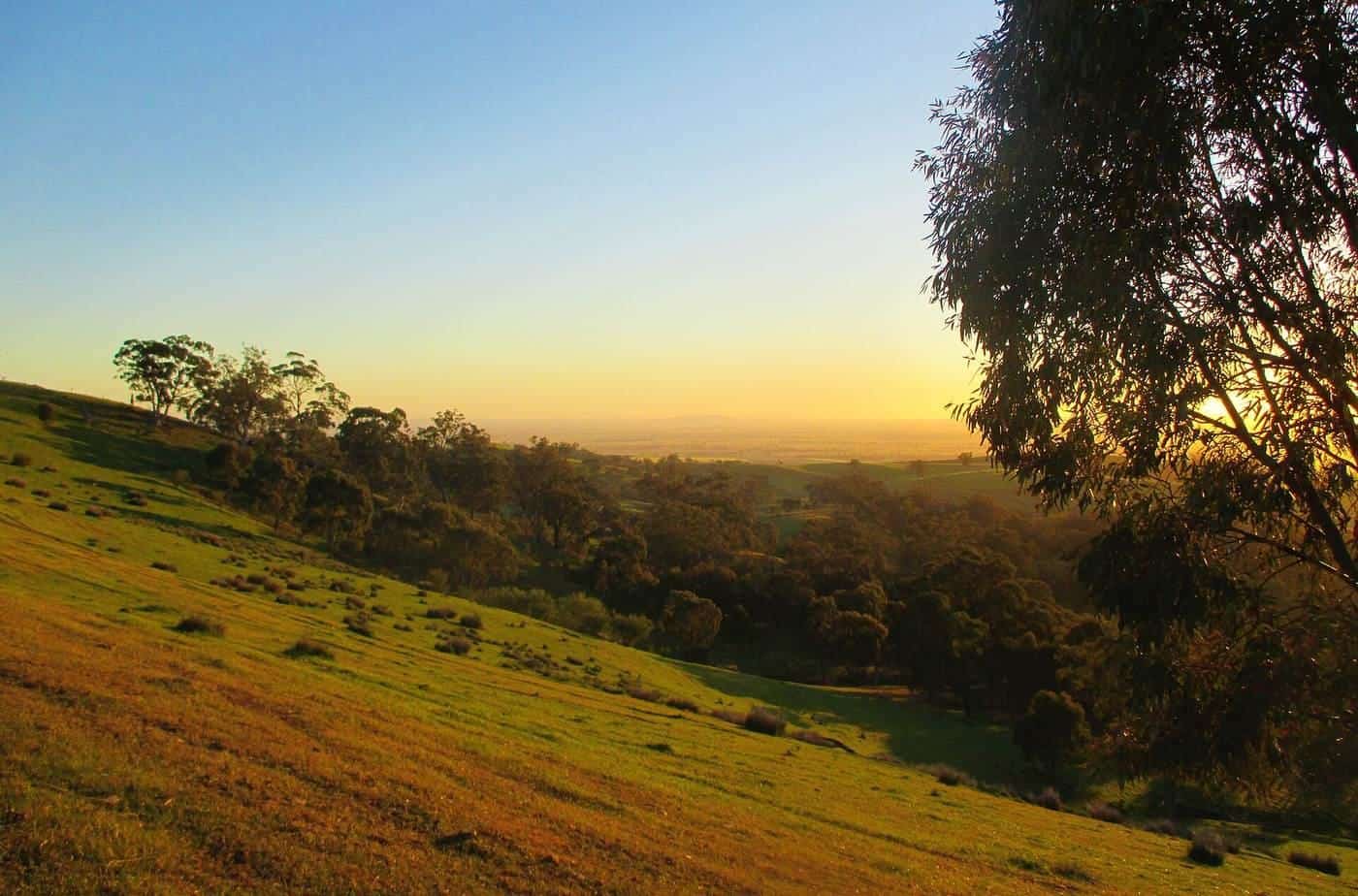
Munda Biddi, the Foundation says, translates to “path through the forest” in the Noongar language spoken in the south-west. The trail is a 1,072 km off-road adventure cycling route from Mundaring in the Darling Range east of Perth to Albany on the south coast. It traverses eucalypt bushland, granite outcrops and coastal landscapes in a relatively undeveloped natural corridor — a fact the Foundation ties to the south-west’s status as a global biodiversity hotspot.
This page is a touring field guide: when to go, what the dirt actually is, how the shelters work, and how to plan a section without turning the ride into a highway story. It does not sell a supported product and it does not invent a daily itinerary for hire. For the general dirt-touring argument see gravel touring. For Western Australian road rules see road rules.
What kind of trail this is
The Foundation’s own category is the one that matters: a unique off-road adventure cycling and bikepacking trail, mostly away from motorised vehicles and busy highways, made of natural surfaces. Terrain includes rail-trail sections, singletrack and forest roads. There are many access points and road crossings for drop-offs. Sections suit a range of riders from beginners to the more experienced — and, in the next sentence, the Foundation recommends some mountain-biking or gravel-biking experience if you want to enjoy it.
That pair of sentences is how you should brief a group. A first-time visitor can enjoy a well-chosen section near a town. An end-to-end crossing is an expedition. Neither is a shuttle-up, ride-down park day. This site will not describe jump lines, berms as a product, or a downhill grade. If that is what you came for, you are in the wrong guide.
Compare the Mawson only as another official dirt touring route: ORSR’s close-to-900 km South Australian trail is farm tracks and ranges rather than a continuous forest corridor. The two are cousins in planning (water, fire, off-road bikes) and strangers in landscape. See Mawson Trail.
1,072 km
Length
Foundation: Mundaring to Albany
Late Mar–Nov
Weather window
Foundation, south-west WA
12
Forest shelters
Generally 40–60 km apart
Surfaces: pea gravel north, loam and sand south
The Foundation splits the dirt in a way a single “gravel” label hides.
Mundaring toward Manjimup is distinctive red pea-gravel. It moves. Narrow tyres plough. A hurried line on a loaded bike is how people add walking to a day they had called intermediate. If your home loops are packed granite rail trail, treat the first northern section as a new surface, not as “more of the same”.
The southern country toward Albany is a combination of loamy soils and fine white sand. Loam after rain is a different steering problem from sand after a dry week. Coastal light and forest shade will both lie about how firm the next corner is.
Rail-trail pieces and forest roads sit inside both halves. Singletrack sits inside both halves. Choose a section for the bike you packed, not for a photograph of karri or a granite dome.
After rain, natural surfaces hold water. After a long dry, they corrugate and throw stone. The Foundation’s seasonal window is partly a surface window. Re-read Parks and Wildlife and Foundation notices the week you ride; we will not invent a mud index.
The season the Foundation already published
The Foundation says the window of cycling weather is generally good between late March and November in the south-west, and that summer in the northern jarrah forests can get extremely hot (over 40 degrees). That is the starting filter. It is not a booking, and it is not a BOM station table.
What that window is doing:
- Heat. Northern jarrah in high summer is a medical problem on a loaded bike, not a character test. We will not add a made-up Collie average. If you want a number, fetch the BOM station table for the town you will sleep in. See seasons.
- Fire. Dry forest is fuel. Parks close. Ride a sealed town connector if you must move; do not invent a “quick highway stage” through a ban. The trail is a forest corridor on purpose.
- Winter inside the window. South-west winters are the wet half of a Mediterranean climate. Days are shorter. Loam is softer. A section with a town at each end is a different ride from a shelter-to-shelter day in July.
The trail has been described elsewhere as open year-round in later years. The Foundation’s about page is still the seasonal voice this guide follows: late March to November is the window it is willing to call generally good. If you ride outside it, you own the heat and the fire rating.
BOM’s climate portal is the forecast voice the week you leave. The Foundation’s Facebook and community channels are the noticeboard it points to for trail notifications. Use both. A screenshot from last spring is not a plan.
Management, access and the fact that it is free
The Foundation says the trail is managed in partnership between the Parks and Wildlife Service (DBCA) and the Munda Biddi Trail Foundation, whose staff, board and volunteers help with maintenance, improvement and promotion. It describes the trail as a free adventure resource and asks people to give back — volunteer time, become a member, or donate via the National Trust Natural Heritage Appeal.
That sentence is the opposite of a tour-operator product. You may still buy lodging, food, a shuttle, or a guided week from people who work along the corridor. We will not name them, rank them, or invent a tariff. See self-guided versus guided for the trade-offs, then buy from the person who actually drives the van.
Access, the Foundation says, is helped by many points and road crossings. That is why sectional riding is the normal way in. You do not have to earn Albany from Mundaring in one leave pass. You do have to arrange the vehicle or coach that matches the section you chose. We will not invent a timetable.
Learn the Noongar and settler history from the people and interpretive material along the route, not from a paragraph we would have to invent. The Foundation invites that attention. Stay on the trail. The biodiversity hotspot sentence is a reason, not a caption.
Shelters, towns and the night
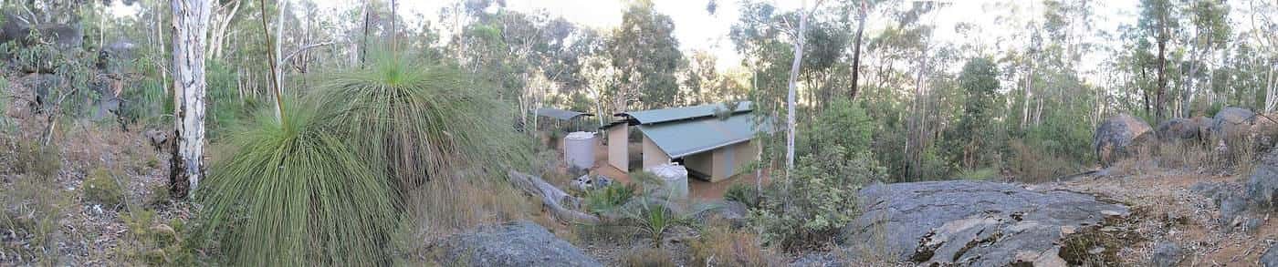
The Foundation describes a series of 12 purpose-built shelters nested in the forest between country towns, generally every 40–60 km. They are given Noongar names. Each consists of a shelter with sleeping bunks, two water tanks, picnic tables, tent sites, a toilet and bike storage. They are fire-pit free — pack a fuel stove and warm clothing.
Those distances are a planning range, not a promise that every rider will find 40 km an easy day on pea gravel with luggage. Some people will want a town night in between. Towns along the wider corridor — the names you will meet in Foundation maps and ordinary south-west geography, such as Collie, Manjimup, Northcliffe, Walpole and Denmark — are where resupply, a shower and a public socket live. Confirm services the week you ride. We will not invent opening hours.
Tanks are infrastructure. They are not a laboratory. After a dry spell or a busy week, carry more water than a tank icon on a map suggests. Treat water as if the next tap failed — the same habit ORSR teaches on the Mawson.
If you camp, camp where it is actually provided. If you stay in town, you are still on a touring ride; the forest does not become a rail trail because you booked a room.
Bikes, bags and the loaded-hour test
Pack an off-road touring bike you have already ridden on loose surfaces with weight on it. A sturdy mountain bike or a gravel bike with honest tyres is the shape of that sentence. A road bike is the wrong shape. A heavy city e-bike with skinny tyres is the wrong shape unless you have proved, on dirt, that it is not.
Legal e-bikes in Western Australia are a state-definition problem before they are a trail-surface problem. The Road Safety Commission requires riders to be 16 or older, limits Pedalecs to 250 W with assistance cutting at 25 km/h, and treats non-compliant machines as unlicensed motor vehicles. Confirm that page. Confirm whether the section you want is a place you are willing to carry a dead motor. Charge in towns, not from a fantasy about forest sockets. See e-bike touring.
Bags: many riders prefer frame, seat and handlebar bags on brushier pieces so the load stays in the triangle. Racks and panniers still appear on firmer forest roads if the width is sane — WA’s bicycle-standards note that a load cannot exceed 800 mm. Test either setup on a loaded hour at home. See what to pack.
Rules that travel with you into the forest
Western Australia still thinks you are a bicycle rider when the surface turns to pea gravel.
- An approved helmet, securely fastened, unless you hold a written exemption. Austroads lists WA medical and religious exemptions as discretionary paperwork, not as a vibe.
- Lights if you might finish late or enter a dark cutting: WA wants white front and red rear lights visible for 200 metres, plus a reflector set.
- A bell or other warning device. Forest paths are shared with walkers, and forest roads are shared with vehicles.
- Ordinary road rules whenever the trail uses or crosses a road. Freeways are not for bicycles. Ride on the left.
The passing-distance conversation on highways is a reason not to “link sections” on a fast road you have not inspected. The Foundation’s trail exists so you can stay off busy highways. Use that gift.
Remote habits sit beside the statutes: a trip plan with someone at home, a messenger that works without coverage, a first-aid kit, and the humility to turn around. We will not invent a coverage map.
Planning a section instead of a myth
End-to-end is several weeks for most people and a different sport for the ultra-riders who treat it as a clock. This guide is for the first group.
A method that respects the Foundation page:
- Write 1,072 km down, then write the section you will actually ride. Mundaring–Jarrahdale is not Albany.
- Name the surface (pea gravel versus loam and sand) and pick the bike for that half.
- Name every night — shelter or town — and check the 40–60 km range against the hours you like to ride on dirt with bags.
- Plan water as if a tank is low.
- Apply the late-March-to-November window, then read BOM and fire-danger the week you leave.
- Arrange the drop-off the access points make possible. Do not assume a random forest road is a shuttle.
- Pack a fuel stove if you will use a shelter.
The home-page calculator can turn riding hours into a day count. It does not know sand, wind, or a closed park. If a day-split ignores a climb or a dry tank, shorten the day.
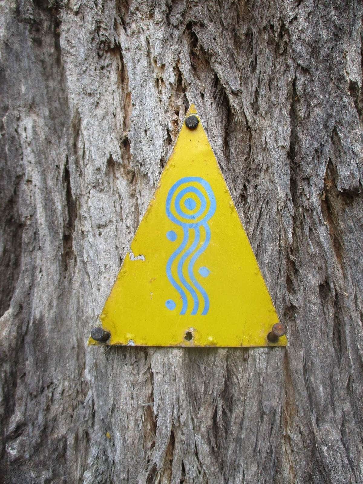
Navigation: carry official maps or the Foundation’s planning tools, offline. Markers exist. So do unsigned forest junctions. The trail is not a rail-trail easement you can follow with your eyes shut.
Respect, closures and the corridor
Stay on the formed trail. The Foundation’s biodiversity sentence is not decoration; dieback, nesting seasons and fire recovery all produce closures that look arbitrary only if you wanted a park to behave like a gym.
Carry waste out. Do not light a pit that is not there. Do not ride a closed section “to see”. A closed section is a hazard for you and for anyone sent to help — the same sentence Rail Trails Australia has had to print on other trails after fire.
If you want to give back, the Foundation has already named the mechanisms. Membership and volunteer time keep a free trail free.
A touring checklist for this trail only
Munda Biddi touring checklist
0 of 8 done
Ticks are saved in this browser only.
Related reading
Gravel touring for why this is dirt touring. Western Australia for state context. Seasons for fire and heat. What to pack for the stove and the messenger. Mawson Trail if you want the South Australian cousin. Self-guided versus guided if the question is a vehicle, not a forest.
Frequently asked questions
How long is the Munda Biddi Trail?
The Munda Biddi Trail Foundation describes a 1,072 km off-road adventure cycling trail from Mundaring to Albany in Western Australia.
What does Munda Biddi mean?
The Foundation says Munda Biddi translates to “path through the forest” in the Noongar language spoken in the south-west of Western Australia.
When should I ride the Munda Biddi?
The Foundation says the window of cycling weather is generally good between late March and November in the south-west, and that summer in the northern jarrah forests can get extremely hot (over 40 degrees). Check BOM and fire notices the week you ride.
What bike do I need?
This is natural-surface off-road touring. The Foundation recommends some mountain-biking or gravel-biking experience if you want to enjoy the trail. It is not a road-bike route and it is not a downhill-park brief.
Who manages the trail?
The Foundation says the trail is managed in partnership between the Parks and Wildlife Service (DBCA) and the Munda Biddi Trail Foundation.
Are there shelters on the trail?
Yes. The Foundation describes 12 purpose-built forest shelters with Noongar names, generally 40–60 km apart, with bunks, two water tanks, picnic tables, tent sites, a toilet and bike storage. They are fire-pit free.
Sources and further reading
Facts on this page were checked against these primary and official sources. Conditions change — confirm before you travel or buy.
- About the trail — Munda Biddi Trail Foundation
- Bicycle riders — Government of Western Australia
- Helmet use — Austroads
- Climate data — Bureau of Meteorology
- Mawson Trail — Office for Recreation, Sport and Racing (SA)